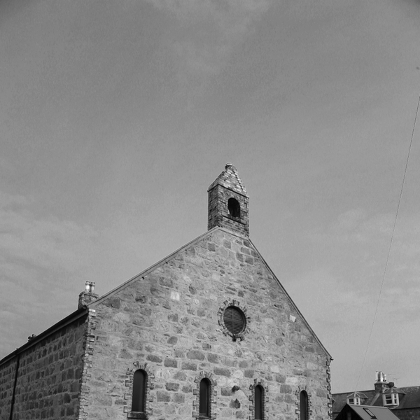
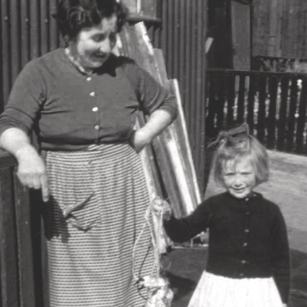
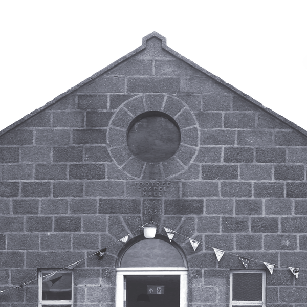
Voices of Footdee

room 5 ECHOES

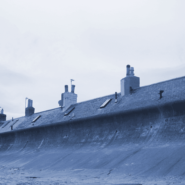
Location: Aberdeen, Aberdeen City, Scotland, United Kingdom

Residents of Footdee talk about life in the village past and present.


DOWNLOAD OUR APP TO DISCOVER THIS TOUR AND MANY OTHERS.

play-storeapp-store

The Echoes


A Changing Community - Past/Present

Residents of Footdee talk about the transformation of the area from a close-knit fishing village to …

Deep Dive - North Sea Leisure

Wild swimming enthusiasts from Footdee talk about their passion for plunging into the icy waves. Im…

Childhood Dreams - Growing Up In Footdee

Footdee residents share their memories of growing up in the village from the 1950s to 1980s. Image …

The Sea's Bounty - Working in Footdee

Residents of Footdee discuss working on the sea - from the shipyards and the harbour, to oil and gas…

A Changing Community - Present/Future

Current residents of Footdee talk about present day community life and the village's future in the f…

Discover more geolocated content in our apps.
play-storeapple-app-store

Or start creating tours, treasure hunts, POI maps... Just let your imagination guide you.


Other walks nearby

Granite Sound Walk

Granite Sound Walk

Commissioned by National Theatre of Scotland
free
Lovers’ Walk, Culter

Lovers’ Walk, Culter

A walk along the north bank of the River Dee- traditionally known as Lovers’ Walk, returning by the Deeside Way to the Station Car Park. The length of this walk is 2km/1.4miles. The walk starts at the Car Park- you can go either way. The walk is mainly on the flat, with a small incline at the bend of the River Dee, another opposite Inchferry, and the entrance to the Deeside Way at Pittengullies. There are benches along the route for you to stop and take in the scenery. Please be aware that cyclists and horses may also be using the route. You can Stream the walk - press "Stream Walk". This will use GPS to play each segment when you are in the specified area. In case of patchy connectivity, you can download the complete walk before you begin. Choose "Lovers' Walk". Press "Start". When you see the map of the Walk, press the menu in the top right hand corner. This gives you the opportunity to turn off "Autoplay", and play each segment individually.
free
SAND, SILT, FLINT - BONNY UDNY

SAND, SILT, FLINT - BONNY UDNY

UDNY GREEN - BONNY UDNY - FROM THE ALBUM "SAND, SILT, FLINT" BY FIONA SOE PAING https://FionaSoePaing.bandcamp.com Bonny Udny is one of Aberdeenshire’s favourite ballads and is recorded being sung by a number of North East Scotland’s best known ballad singers including John Strachan. This wistful folk song waxes lyrical on the charms of Udny, a small rural hamlet and home to the singer’s sweetheart. It’s many melancholy verses detail how hard it is for the singer to leave the village and that its pastoral charms along with the charms of their sweetheart are always ‘aye on’ the singer’s mind while they are away. Although well known in Aberdeenshire, other similar ballads exist across the UK detailing similar idyllic villages and lovers that are hard to leave and always yearned to return to. Udny Green Walk The parish of Udny consists of Udny, Udny Station (located on the former railway line to Peterhead and closed in 1979) and Udny Green all of which are a handful of miles east of Oldmeldrum. Serious walkers can explore a stretch of the Formartine and Buchan Way, a mainly flat path that follows the old railway line and stretches for 53 miles through rural Aberdeenshire. Walkers starting at Udny Station can head south through open countryside for around eight miles to reach Dyce, a western suburb of Aberdeen. Or head north for five miles to the small town of Ellen. For less serious walkers, or if time is limited, head to Udny Green whose large tree lined village green is a perfect place to let go of time, simply meander and let children play. The green is surrounded by charming old buildings including the village church and war memorial and a haven of timeless peace. The benches and picnic tables dotted around the green are all tranquil spots to take in Udny’s bonnie charms and maybe even fall in love. Practical Information Walkers joining the Formartine and Buchan Way at Udny Station will find parking there as well as Dyce and Ellen. While street parking is available around Udny Green. Those travelling on public transport can catch the Stagecoach bus 290 than runs between Aberdeen and Methlick and stops at both Udny Station and Udny Green. The Coffee Apothecary (open Monday – Thursday 10am to 4pm and Friday to Sunday 9am to 4pm) east of Udny Green at the junction of the B9000 and B999 serves speciality coffee and simple hearty meals made from as much local produce as possible in rustic surroundings, or head north to nearby Pitmedden for a food store. If time and budget allows, take time to enjoy a dinner to remember at Eat on the Green, a contemporary Scottish themed fine dining restaurant located on the edge of Udny Green in the transformed local pub. Text for the Soundwalk researched and written by Lesley-Anne Rose at https://OpenRoadLtd.co.uk , with many thanks. Image with thanks to Isla Goldie Photography
free
SAND, SILT, FLINT.  FORVIE WALK

SAND, SILT, FLINT. FORVIE WALK

Created by Aberdeenshire musician Fiona Soe Paing, with an accompanying short film by Dudendance Theatre, with support from Help Musicians UK Fusion Fund and Creative Scotland. The walk begins at the Forvie National Nature Reserve Visitor Centre and is one of a series of trails mapped out across the reserve. This walk leads from the gate at the visitor centre and follows the Heath Trail which is illustrated by waymarkers showing a white four-leaf clover set against a red background. This circular trail leads from the visitor centre and loops through heathland and dunes in the north of the reserve. This option leads a 1.4 mile loop into the reserve and skirts along the end of the Sand Loch. (On completion of the walk, make your way to the Visitor's Centre -to the Fire Exit door on the left- to view the stunning short film created for the music by award-winning performing arts company Dudendance.) Before setting out take a moment to run your fingers through the Living Wall, a vertical garden beside the entrance to the visitor centre filled with pollinator-friendly plants and flowers perfect for the surrounding landscape. Once the sounds and views of the visitor centre have faded, the slow, sandy landscape becomes disorientating. It’s easy to lose a sense of time and direction and the sound and smell of the sea to the east is the easiest way to orientate yourself. Look up for low flying sea birds and wide open skies. And look out for heather, crowberry, lichen, staghorn clubmoss and low cut willow trees, as well as wild flowers during late spring and early summer. The path includes sections of gravel, sand and grass, with parts closer to the visitor centre better for buggies and walking sticks. Some later sections cover uneven ground and undulate across the landscape in places. Smaller sand tracks crisscross into and across the dunes for the more adventurous to explore. Wet weather turns the trail muddy in places and sections of the longer walk can become flooded. But on these days you can also breathe in the pungent smell of earth and sand. Ice on the paths can be a hazard in chilly deep winter. On windy days a keen breeze cuts across the dunes from the North Sea, spinning through the blades of a small wind turbine adjacent to the visitor centre. On these days it’s easy imagine the wild storm that smothered the village that once settled here, its church, lives and livelihoods, with unstoppable sand. 
“Let nought be funde in Forvie’s glebe but thistle, bent and sand.” Forvie boasts some of Britain’s largest sand dunes and although a wild, uninhabited landscape today, it was once home to one of a series of small settlements that grew along Scotland’s north east coast supported by fishing and farming. The community laid roots down around a small stream that cuts through the centre of the reserve and meets the sea at Rockend. Over the course of time the dunes at Forive have stabilized as grass and heather took root, but centuries ago the sands shifted with wind and tide. Finally beaten by advancing dunes, the settlement was abandoned in the early 1400s. The only building to survive is the village church whose ruins date back to the 12th century and stand on the site of an earlier 8th century chapel. Little is known about the settlement and how long it took to surrender to restless sands, but local legend tells of a swift demise. Two versions of the curse that called forth the mighty storm that engulfed the village exist. The first spins a sinister tale of a demon priest responsible for the disappearance of young girls. Once the villagers discovered his dark ways he summoned a storm to destroy the settlement and enable his escape, leaving nothing but the top of the church remaining. The other claims three sisters raised the storm in a curse on the village after being driven out to sea in a leaky boat in an attempt to deny them their inheritance after the death of their father the Laird. Their storm raged for nine days and nights and buried everything in sight in sand. Legend aside, what is known is the meteorological records from August 1413 which detail extreme tides and high winds that blew sand from the surrounding beach into a huge dune possibly fulfilling the sisters’ curse, “Let nought be funde in Forvie’s glebe but thistle, bent and sand.” The alternative route follows a 2.1 mile loop deeper into the landscape and sea cliffs. The longer option rewards with wide sea views with Aberdeen to the south, Collieston to the north and off shore wind turbines to the east. Practical Information Getting There FORVIE VISITOR CENTRE, COLLIESTON, AB41 8RU Forive National Nature Reserve is approximately 16 miles north of Aberdeen. If you are driving, take the A90 north out of Aberdeen and then turn onto the A975 to Cruden Bay. The visitor centre car park is about three miles north of Newburgh. Once past Newburgh turn right at the Collieston crossroads from here the visitor centre is signposted. If you are taking public transport, Stagecoach operate buses between Aberdeen and Peterhead which stop at both Newburgh and the Collieston crossroads. It’s a 20 minute walk to the visitor centre from the crossroads. Visitor Centre Forive Visitor Centre is open daily from April to September and is full of information about the nature reserve including tactile exhibits. Toilets Accessible toilets are located inside the visitor centre, other public use toilets can be found at Collieston harbour to the north, or in Newburgh at the Newburgh Inn. Refreshments Wheelchair accessible picnic tables are located in the grounds around the visitor centre and overlooking the Sand Loch. The nearest place for eat in food is the Newburgh Inn. Wildlife Warning Do not disturb breeding or roosting birds or the seals who haul out on the shore along this coast. Dogs must be kept on leads during nesting season (April to July). ----- Produced by OpenRoadLtd.com in association with NatureScot. Music by FionaSoePaing.co.uk Film by Dudendance.com Mixed by Jamie Smith at St Mary's Space Studio Image "Sand dunes grass" by Fi Thomson Text for Echoes app researched and written by Lesley Anne Rose at Open Road Ltd, with thanks. Supported by Help Musicians UK and Creative Scotland With thanks to the Elphinstone institute of the University of Aberdeen,
free
SAND, SILT, FLINT - THE BALLAD OF JOHN HOSIE

SAND, SILT, FLINT - THE BALLAD OF JOHN HOSIE

HOSIE'S WELL - THE BALLAD OF JOHN HOSIE - FROM "SAND, SILT, FLINT" BY FIONA SOE PAING https://FionaSoePaing.bandcamp.com The tragic tale of John Hosie and his sweetheart, and bride to be, Jean is embedded in the landscape and folklore of Bennachie. On July 24, 1411 the Battle of Harlaw, nick named “Reid Harlaw” in recognition of its ferocity and sheer amount of bloodshed, was fought at the foot of Bennachie. The battle brought together two Highland forces, one led by the local Earl of Mar who was loyal to Scottish King David the second, and the other by Donald, Lord of the Isles. The conflict was sparked by their competing claims to the Earldon of Ross, a huge region of northern Scotland leading from Skye to Ross and into Inverness. King David confirmed the land belonged to the Earl of Mar, but Donald disagreed and invaded. Both sides suffered heavy losses during the day long battle aimed at settling the conflict, but after no conclusive victory on either side, Donald and what remained of his troops, withdrew back to the Isles in the night. John Hosie fought on the side of the Earl of Mar, but the battle fell on the day before he was due to marry his beloved Jean. John survived the bloodshed, but was taken prisoner by Donald’s retreating forces and marched back to the Isles with them, leaving behind the broken hearted Jean. Folklore tells us that it was years before John escaped the Isles and hot foot it back to Aberdeenshire and Bennachie where he pledged his heart to Jean. However, believing John to be dead, Jean is now engaged to another man. The story passed down tells us that the day John returned to Bennachie, Jean and her new fiancé happened to be out walking on the hill. With echoes of Romeo and Juliet, Jean is so shocked and distraught at the sight of the long lost John she drops dead on the spot. Overcome with grief John dies too and is soon buried on the spot where he fell. Legend tells us his tears flowed up from the earth to create Hosie’s well, and still make up its waters to this day. Bennachie Walk The craggy granite peak of the Mither Tap dominates views of Aberdeenshire and is one of nine summits spread out across the ancient landscape of Bennachie. A popular walk with locals and visitors alike, this former hilltop Pictish fort is riddled with walking trails and folklore, and rewards anyone who ventures up its rocky slopes with long horizon views of the surrounding countryside and coast. The easiest way to reach Hosie’s Well is to follow the Maiden Causeway trail, which leads from the Rowan Tree Car Park to the north of Bennachie, to the summit of the Mither Tap, scooting past the well on the way. The trail kicks off to a steep, narrow start as it leads upwards from the car park quicky into woodland of Scots Pine and Sitka Spruce. Take time to look out for the red squirrels that call this forest home and to take in the birdsong that accompanies the short, uphill walk through the trees. From here you’ll soon emerge into a heather strewn hillside and unfolding views of the Mither Tap ahead. After about half an hour of steady walking, and a mile from the car park, you’ll reach a level area, dotted with rowan and larch trees, that branches off to the right of the Maiden Causeway. This diversion leads to Hosie’s Well nestled deep within the rocks beneath the grassy ground. The well itself isn't big, but is a good place to pause, unpack a picnic and take in the silence of the hillside. Also take time to read the information board detailing the story of the blood-stained Battle of Harlow and the tragic Hosie, whose heartbroken tears are said to feed the well’s clear waters. If you’ve the time and energy, and the weather is on your side, continue up the Maiden Causeway to the Mither Tap summit. The Causeway itself is the stuff of legend and named after a feisty local girl who made a deal with the devil, betting she could bake a batch of oatcakes in less time than it would take him to build a pathway up Bennachie. The views from the top of the Mither Tap are equally legendary and well worth the scramble to the top to take in. Practical Information Bennachie is managed by Forestry and Land Scotland (https://forestryandland.gov.scot) It is accessible all year round. There is no charge to part at Rowan Tree car park, but do park in the designated area and be careful not to block gateways. To reach the car park follow the A96 north from Inverurie for about eight miles. Turn left onto a minor road signposted to ‘Maiden Stone’, just before the turning to Oyne. After about 1⁄2 mile, take a right turn signposted ‘Rowantree Forest Walks’. The car park is about 1⁄2 mile along this road, at grid reference NJ 692 244. The nearest post code is: AB51 5HZ. This is a popular walk and the car park gets busy at weekends and holidays. If you are travelling by public transport the nearest drop off point is Pitcaple villiage which is about two miles from the car park on the A96 and served by buses between Huntly and Aberdeen. For more information see Traveline Scotland. (https://travelinescotland.com) The best option to eating is to bring a picnic and picnic tables with a view are perched on a grassy bank above the car park. These are not accessible for wheelchair users, but the on site toilets, which are open Easter to September, are. Good walking shoes or boots are recommended as some parts of the trail are narrow steep and rocky. The ground can also get muddy after rain and icy in the winter. Text for the Soundwalk researched and written by Lesley Anne Rose at https://OpenRoadLtd.co.uk , with many thanks.
free
SAND, SILT, FLINT - TIFTY'S ANNIE

SAND, SILT, FLINT - TIFTY'S ANNIE

FYVIE WALK - TIFTY'S ANNIE - FROM THE ALBUM 'SAND, SILT, FLINT" BY FIONA SOE PAING http://FionaSoePaing.bandcamp.com Agnes, or “Annie” Smith, was the bonnie daughter of a wealthy miller who owned the mill at Tifty, a tiny hamlet close to the village and castle of Fyvie deep in the Aberdeenshire countryside. Against the wishes of her family, Annie fell in love with Andrew Lammie the trumpeter for Lord Fyvie who won over her young heart when they met in the woods of Fyvie. Annie’s family refused to give their consent for her to marry a lowly servant who they believed had bewitched their innocent daughter. Her family didn’t just disown Annie, but also took it in turns to beat the love out of her, especially her brother whose cruel repeated blows, according to folklore, also took the life out her. Annie’s dying plea was for her mother to make a bed looking towards Fyvie and her dear Andrew Lammie so she could lie down and die facing the man she loved. Fyvie Walk The Fyvie Estate with its magnificent 800-year-old castle, restored Walled Garden and tranquil grounds lies about half a mile south of Tifty. It’s easy for anyone to fall in love in its magical woodlands, filled with birdsong and wildlife which is a riot of bluebells and cherry blossom in spring and repellent with gold and red in autumn. Fyvie Lake is one of the estate’s focal points and you can follow in Annie and Andrew’s love-struck footsteps on the one and half mile walk around its peaceful banks. All paths lead to Fyvie Castle – a Baronial former fortress whose rich history mixes and merges with local folklore. Each of the five families who once owned Fyvie are said to have built one of its imposing towers. Cast your eyes skywards to spy the statue of a wee trumpeter who stands astride one of the castle’s many turrets. The spirit of Andrew Lammie is also reported to be one of the numerous ghosts who haunt Fyvie. According to local legend if the sound of his ghostly trumpet is heard, it’s a warning to the castle’s resident family that something bad is about to happen. Practical Information Fyvie Castle and Gardens are situated off the A947 to the north of the village of Fyvie which is around eight miles south east of Turriff. Parking, picnic tables, public toilets, a gift shop and tea rooms are all to be found at the castle which currently belongs to the National Trust for Scotland. The grounds are free to walk around, but an admission fee is charged to enter the castle. Opening times and prices can all be found at: https://www.nts.org.uk/visit/places/fyvie-castle. For those on public transport, Fyvie is on the route of the Stagecoach bus no 35 which runs between Aberdeen and Elgin. Text for the Soundwalk researched and written by Lesley-Anne Rose at https://OpenRoadLtd.co.uk , with many thanks. Image with thanks to Isla Goldie Photography
free
Turriff, Scotland, 'Nightingales'

Turriff, Scotland, 'Nightingales'

A remote collaboration between two artists in Cornwall and rural Aberdeenshire. Initially based around the notions of parenthood, whilst also considering personal, geographical and political space. Composition naturally began to accommodate responses to the pandemic as the album was written during the COVID19 lockdown of 2020. The first five tracks use only the voice and audio production techniques, field recordings, an impulse response harvested from a cave on the north east coast of Scotland, and radio excerpts, whilst the final track contains additional instrumentation.
free
SAND, SILT, FLINT - FORGLEN'S PLANTINS

SAND, SILT, FLINT - FORGLEN'S PLANTINS

FORGLEN ESTATE - FORGLEN'S PLANTINS - FROM THE ALBUM "SAND, SILT, FLINT" BY FIONA SOE PAING https://FionaSoePaing.bandcamp.com The old North East ballad linked with Forglen Estate is known as Forglen’s Plantins or Forglen’s Wood – the word ‘plantins’ is Scots for a small wood. Through its lyrical versus an unknown writer weaves a picture of rural idyll as the backdrop for a tale rich with young love, the heartbreak of separation and the uncertainty of if a lover will remain faithful. While taking in the ‘fresh and fair’ air of the plantins one morning the writer is enjoying the beauty of the woods and lark songs when he comes across two young lovers locked in an embrace by the foot of a tree. The writer’s soft footsteps do not disturb the lovers and as he approaches he overhears the young man confessing to his love that, although he dearly wants to stay, he has no choice but to go away. As he breaks his sad new to his ‘dearest’ he showers her with romantic praise claiming she is ‘sweeter to me than the honey to the bee’ and that her cheeks are like roses and her skin as soft as silk. Despite his professed love, the young man isn't convinced she will stay faithful during his absence. He predicates sleepless nights thinking about her while he is away, but proceeds to compare her love for him to the moon which ‘wanders up and down.’ The ballad concludes with the young man’s assurances that his love for her is much more like the constant sun as he promises to remain true to her while he’s away. Unfortunately, we don't know her reply to both her lover’s praise and accusations, or if the writer was discovered eavesdropping on their conversation. However, we do know that the ballad and the young lovers it depicts have also been ascribed to other places in the North East such as Strichen, twenty miles east of Forglen. Forglen Estate Walk Forglen Estate is one the North East’s best kept secrets and it’s not hard to imagine the ballad’s unknown writer drawing inspiration for his tale of young love from its rural setting and aura of romance. Once you pass through the estate gates it takes no time at all to get lost in the peace of the pathways and trails which gently weave through acres of woodland and alongside the banks of the River Deveron. Originally Forglen belonged to the Ogilvy family through their claim on the Scottish peerage title of Lord Banff. However, following the death of the unmarried William Ogily the 8th Lord Banff in 1803, ownership passed to the Abercromby family through the marriage of the late Lord’s sister. They in turn sold up in the mid 1970s. Today Forglen remains privately owned and a working estate, growing barley for the region’s whiskey industry. Deer, Highland cattle and native birds of prey such as sparrow hawks and buzzards also all call the estate home and could well be spotted during a walk. However, one of the highlights of a visit is the magnificent Forglen House which sits about a mile from the entrance to the estate. Although only built in the early nineteenth century, the house stands on the footprint of a much older building and contains some of the features salvaged from its processor including a stone triple coat of arms which sits on one of its towers. Gothic in feel and style, the mansion was designed by Scottish architect John Smith who is also responsible for much of the architecture of Aberdeen. Although not open to the public, it’s well worth the walk to see it and take in the stunning river views that stretch out in front of the mansion’s wide lawns. Also take time to explore Forglen’s magical, glen garden which is landscaped around a small stream and reached through a gate close to the house. The looped walk through the garden’s rambling peace is about a mile long and features an old stone bridge and wooden benches tucked under the trees, which are perfect to enjoy the sounds of the stream and complete silence beneath it. The trail around the garden can be very slippery in wet weather. Other estate highlights include a Gothic mausoleum built in the mid 19th century. Ultimately, one visit to the estate isn’t enough and once you’ve discovered it’s beauty, like the young lover in the ballad of Forglen’s Plantins, you’ll be sad to leave and look forward to returning. Practical Information Forglen Estate, Turriff, Aberdeenshire, AB53 4JP Forglen Estate is located a couple of mile north west of Turriff. Follow the B9025 as it leads north and then west from the centre of Turriff until you come to the gates of the estate on the right hand side of the road. There is a small road and layby in front of the gates where cars can park. From here pass by the gate house and into the estate. It’s then a straight walk along the track through the woodland to Forglen House. You can either return the way you came or take a circular walk of around three miles around the estate which leads back to the layby by a track which emerges just past it. There is a selection of self-catering holiday cottages as part of the estate which can be booked at https://forglen.scot There are no amenities for visitors at the estate. Shops, cafes and public toilets can all be found at Turriff. Text for the Soundwalk researched and written by Lesley-Anne Rose at https://OpenRoadLtd.co.uk , with many thanks. Image with thanks to Isla Goldie Photography
free
Sonic Border by Januario Jano

Sonic Border by Januario Jano

A new sound installation by artist Januario Jano is situated across seven sites in Huntly, Aberdeenshire. The public artwork, developed whilst on residency at Deveron Projects, traces (and imagines) the journey of migratory birds, primarily passing through Angola, reaching the north of Scotland. The project began with a focus on Huntly’s infamous swift population and has evolved to include seven migratory birds. Through archive and newly recorded sounds of Common Swifts, Spotted Flycatchers, Red Knots, Common Starlings, Sedge Warblers, Common Terns and House Martins, Januario has composed a complex soundscape that reflects on migration and assimilation of human and non-humans. Moving above geographic borders, a process of assimilation for birds is distinctive from people and plants, and politics, but equally requires hospitality for survival. Habitual in their migration, Swifts return to the exact home (nesting in roofs, under tiles, under eaves and within gables) annually. So methodical in their nature that should the home have been removed, the Swifts will continuously knock themselves against the spot that their nest resided that the impact will often kill them. To what end to we, humans, require the kindness and considerations of others to be at home? The soundscape maps a 45-minute circular path and the sites for each track are marked by seven 'non-native' plants, imbedded into Huntly's landscape: Crocosmia, Pampas Grass, Cotoneaster, Peiris Japonica, Hydrangea, Japanese Maple and Lavender.
free

Are you a creator?

START HERE

Privacy & cookie policy / Terms and conditions

© ECHOES. All rights reserved / ECHOES.XYZ Limited is a company registered in England and Wales, Registered office at Merston Common Cottage, Merston, Chichester, West Sussex, PO20 1BE

v2.4.29 © ECHOES. All rights reserved.