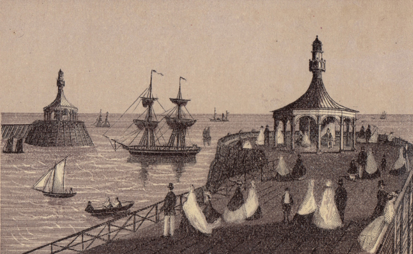
Lowestoft, The South Pier and Royal Plain

room 10 ECHOES

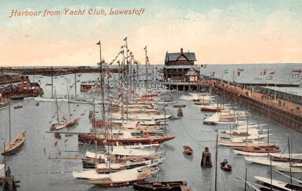
Before the Harbour and the cut to Lake Lothing was created, there was no real harbour here but a wide shingle beach. You could walk across from Kirkley to Lowestoft. If the tide was high sometimes men would carry people on their backs through knee-deep water. Lake Lothing, in Oulton Broad, was a freshwater lake completely divorced from the sea.

In the 1830's and 40's a group of men wanted to create a way to get merchant boats up to Norwich without having to pass through (and pay the tolls to) Great Yarmouth and so created a series of cuts and canals through the Broads and by way of Lake Lothing that linked Lowestoft to Norwich.

Then they went bankrupt. Good idea. Bad accounting.

Sir Morton Peto saw the potential of turning Lowestoft from a sleepy fishing village to a major port and stepped to in finish dredging, build a proper harbour and lay down the most easterly rail line in Britain.

Within the space of 15 years, Lowestoft changed completely. The town went from pastoral to posh in the space of a generation.

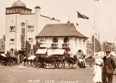
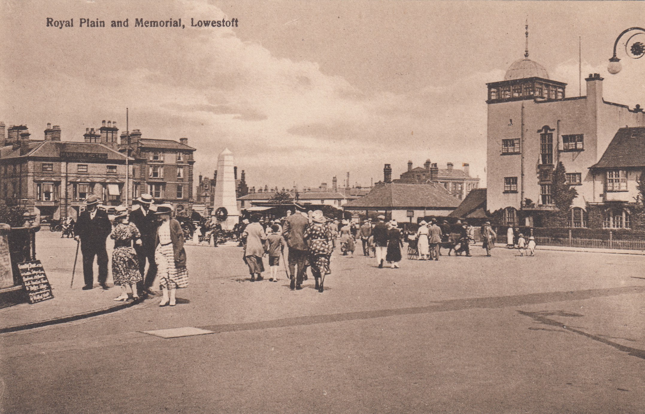
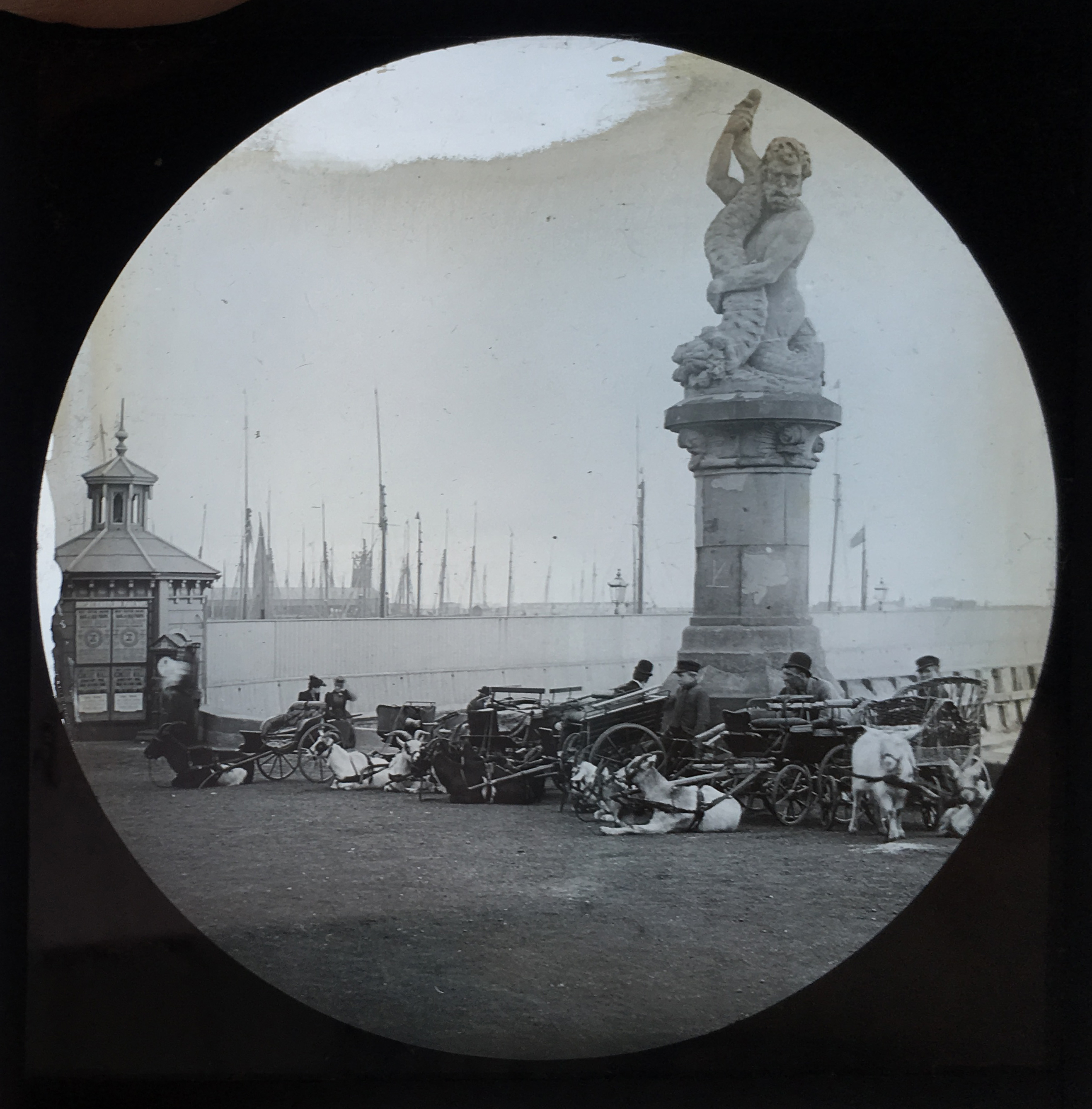
The Royal Plain and the South Pier were two early tourist developments and were immediately ringed with grand hotels, a promenades and soon, a bustling town with trendy shops and fancy houses.

A bridge was built, the first of several, linking this part of Peto's new development with the old High Street and the fishermen's beach village and soon 1850's Lowestoft was one long, narrow town stretching from the High Light to Carlton Road.

This area was the gateway to the south part of Lowestoft and has grown, changed, been demolished and rebuilt along with each phase of the town's development.


Alice Taylor
Alice Taylor

DOWNLOAD OUR APP TO DISCOVER THIS TOUR AND MANY OTHERS.

play-storeapp-store

The Echoes


The Pier Head

The Pier Head has always had navigational and warning lights on the end and sometimes a tea room! I…

The Royal National Lifeboat Institute, Lowestoft

The Lowestoft Lifeboat Station is one of the oldest in the nation, and was founded in 1801, 23 years…

Mincarlo, LT412

The Mincarlo is the last surviving sidewinder fishing trawler of the Lowestoft fishing fleet and the…

The Lowestoft Ferry, MV Terrier

The Lowestoft Ferry is a water taxi that sails between Oulton Broad and the South Pier. It leaves t…

The Royal Norfolk and Suffolk Yacht Club

The NSYC was founded in 1859 when a group of "boating gentlemen" founded the club as way to promote …

The War Memorial

The War Memorial commemorates all soldiers, but was built to remember the many from Lowestoft who di…

The Fountains

The Fountains on the Royal Plain were built in 2005 and have been bringing joy to the hearts of chil…

The Triton Statue

There are two statues of Triton, God of the Waves, on the Lowestoft Promenade. They were commissione…

The Yacht Basin

The Yacht Basin is managed by the Royal Norfolk and Suffolk Yacht Cub for the benefit of leisure yac…

The South Pier

South Pier (built 1846) was one of the first major construction projects built in Lowestoft by Sir M…

Discover more geolocated content in our apps.
play-storeapple-app-store

Or start creating tours, treasure hunts, POI maps... Just let your imagination guide you.


Other walks nearby

Lowestoft, WW2 Military Walk

Lowestoft, WW2 Military Walk

Lowestoft was heavily bombed in both WW1 and WW2. It was on of the first towns in the UK to be hit by bombs from the air during a zepplin raid in 1916. In WW2, it had more bombs rained down on it per head of population than any town in the UK. We were bombed by zepplins, doodlebugs, rockets, phosphorous and conventional. We were bombed from the air and from the sea. This walk will show you the scars from the both wars as this town faced devastation from the east.
free
The Scores of Lowestoft

The Scores of Lowestoft

Scores are unique to the eastern area of Suffolk, where many ‘beach’ families resided. The scores were believed to have ancient origins and were formed over many years by footsteps eroding paths into the soft sloping cliffs leading to the beach, eventually forming the footpaths, with steps added to some. Although the exact origin of the word score is unknown, it is thought it could be a corruption of ‘scour’ or possibly from the Old English ‘skor’, which means to make or cut a line. Over the centuries scores were established connecting the beach to the main road through the north end of town. The Beach Village (demolished in a slum clearance program from 1955 to 1960’s) consisted of tiny rows of 17th and 18th century fisherman’s cottages, smokehouses and net yards. The scores formed a vital link between the town and the beach village, which was built on a cliff and joined to the high street above the village by the series of steep scores. The village housed much of Lowestoft’s fishing communities through the centuries. The original town centre had large elegant 17th and 18th century merchants houses with terraced gardens known famously as the ‘hanging gardens’. Between the houses is where the pathways known as scores appeared. Since the decline of the beach village, the scores are not used so much. On this map are 11 of the scores that are still mostly complete and easy to access. Created by the Great Yarmouth Preservation Trust Scores Project. Funded through Making Waves Together – National Lottery Heritage Fund, Arts Council, Great Yarmouth Borough Council and East Suffolk Council. Words by Lesley M. Bunn. Map created by Catherine Allen.
free
Lowestoft, Kensington Gardens History

Lowestoft, Kensington Gardens History

Kensington Gardens was built in 1922 in the inter-war period as a public works project for unemployed men coming back from WW1. Much of the landscaping is from reused concrete, which shows that Lowestoft was into recycling before recycling became popular. The Japanese inspired theme was popular at the time and reflected what Lowestoft thought looked oriental, even if a real Japanese visitor would look at the garden in puzzlement. Nonetheless Kensington Gardens, with its genteel Edwardian style, peaceful atmosphere and quiet nooks to sit and ponder, is lovely by any measure. While you're here, please enjoy the Tea Room. There's nothing finer than a lovely summer day and sitting outside with a cream tea and watching the bowlers. You can see more views of Kensington Garden throughout the years at http://www.lowestofthistory.com/places/kensington.html
free
The Existing Rows of Great Yarmouth

The Existing Rows of Great Yarmouth

In 1260, Henry the Third gave permission to the town to enclose itself with a wall. The walls not only kept the invader out, but determined the size and shape of the town for many centuries as no one was permitted to live outside of the walls. By building in parallel lines, more space could be better utilized, and so around 150 Yarmouth rows were built. Not all the rows built in this time period have survived to this day. Factors such as bomb damage during World War One and World War Two, fires, and new buildings such as factories and new roads have meant that large portions do not exist. This trail map marks each row that still exists. It is advisable to start at Row 2, and work south, however if you do not have enough time to complete a full circuit, we recommend starting at Row 44 as many of the Rows from this one onwards are close together and easy to find. Created by the Great Yarmouth Preservation Trust Rows Project. Funded through Making Waves Together – National Lottery Heritage Fund, Arts Council, Great Yarmouth Borough Council and East Suffolk Council. Trail map created by Catherine Allen, using predominantly sources from Colin Tookes book, The Rows of Great Yarmouth, and Yarmouth is an Antient Town by A. A. C. Hedges.
free
The Venetian Waterways

The Venetian Waterways

An audio tour of the historic Venetian Waterways, Ornamental Gardens & Boating Lake. Brought to you by Ian (Head Gardener).
free
Sound Systems

Sound Systems

Sound Systems explores our very own individual theme tunes; the songs our nervous systems crave and sing. Produced by Roxanne Matthews and the BBC Voices team. You can discover the Young Norfolk Arts Collective’s own Sound Systems throughout Norfolk as part of the trail.
free
Prophecies

Prophecies

Prophecies is an audio work about the future created by Artist Maddie Exton. Maddie has interviewed Jane Hedges (the Very Reverend of Norwich Cathedral), Penny Francis (a psychic medium), Vonnie Spooner (a spirit guide) and a group of 7 year olds from Earl Soham Primary School to ask them what the future looks like. Harnessing a range of voices, Prophecies will invite listeners into a moment of intimacy with each speaker and open a space for reconnecting with dreaming. The past year has plunged many into survival mode and Prophecies pushes us to be curious again. Religious spaces are a place people often look to for answers and hope, and as such, being set in the Cathedral grounds, the short trail can act like a modern pilgrimage. “In crises, we pray. Our engagement with religion continues to change, and I wondered how God can act as guidance in the modern world. In the dark days of post ww1 Britain, spiritualism became so popular it almost overtook the Anglican Church, and that same thirst for spiritual comfort has been mirrored during covid. I spoke to a spirit guide and a medium to see what messages and spiritual lessons we can take forward. Working with a group of children from Earl Soham Primary School, it was refreshing and surprising to see what the young think the world will look like in 25 years, allowing the content to be both playful and poignant, two things I always strive for.”
free
Queer Norfolk Stories

Queer Norfolk Stories

Norwich is a city of strangers. The YNA Collective want to unveil a city that is quite literally built on diversity and community by creating a unique audio tour of the city. 'Queer Norfolk Stories'is a Young Norfolk Arts project that celebrates the wonderful, extraordinary lives of local LGBTQ+ people, created by Sára Lapinova and Ellie Robson. We would like to say thanks to all those involved in helping to make this happen, including Deb, Nell, Tiah-Paige, Stevie and Shell, Sára and finally E.
free
1942: Messages from the Norwich Raids

1942: Messages from the Norwich Raids

When Norwich was bombed: our city's untold stories from the WWII Baedeker Raids. To fully enjoy the experience, please walk slowly to allow time for the recording to finish before you leave the zone.
free

Are you a creator?

START HERE

Privacy & cookie policy / Terms and conditions

© ECHOES. All rights reserved / ECHOES.XYZ Limited is a company registered in England and Wales, Registered office at Merston Common Cottage, Merston, Chichester, West Sussex, PO20 1BE

v2.4.30 © ECHOES. All rights reserved.