Chronicles - Walk 1

7 ECHOES

Location: Bangor, Ards and North Down, Northern Ireland, United Kingdom

John Witchell
John Witchell

This is the first of my Chronicles walks (3.6 miles). You can start this walk at Helen's Bay Station or the beach car park, but I will describe the route from the Coastguard Avenue Car park. From the car park follow the main route, through the gates, down to the shore. Turn right and follow the coastal path all the way around Grey Point until you join Fort Road. Turn left and walk due South, cross the road into the beach car park and walk straight on, along the Columban Way to the station. There is an entrance into the station underpass to the right after the second bridge. Go through the underpass and exit the station. Go right on Bridge Road and then cross over and go up Golf Road. At the entrance to the Golf Course take the footpath on your right and follow this through the woods and down to the shore. Turn left and follow the beack back to Fort Road. Then retrace your steps along the beautiful coastal path. Note that there is a cut through at the end, if you can spot it.

Soundtrack: Orchestral Scherzo by Daniel Williams

The Sea Park

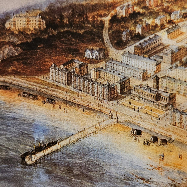
Standing here, in a car park, surrounded by trees, it might be a stretch to ask you to imagine this place in 1850, when you would have been looking across open land towards the sea.

We are at the northwest corner of what was then part of the Clandeboye estate, owned by the young Frederick, Baron Dufferin and Clandeboye. He had inherited Clandeboye at the age of fifteen but did not have any direct involvement until he reached his majority in 1847.

He spent much of his time that winter passing “whole days among the bogs – a somewhat monotonous occupation”, [1] visiting his tenants and contriving ways of improving their lot through the reform of Irish land tenure, mainly through political debate back in England, where he spent much of his time in those early days.

London was where he was able to dabble in politics and pursue a heady aristocratic lifestyle, honed at Eton and Oxford. These were important formative times for the young Dufferin, leading to his appointment in 1849 as Lord in Waiting to Queen Victoria.

In 1850 he returned to Clandeboye which, despite its “misty mockery of a park” [2] , he declared that he loved more than any other place, and employed the services of the landscape designer, James Frazer, to help him create something to match his aristocratic ambition.

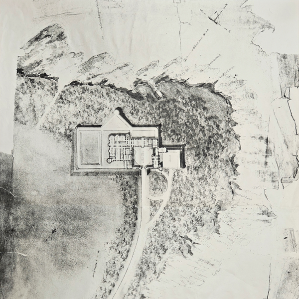
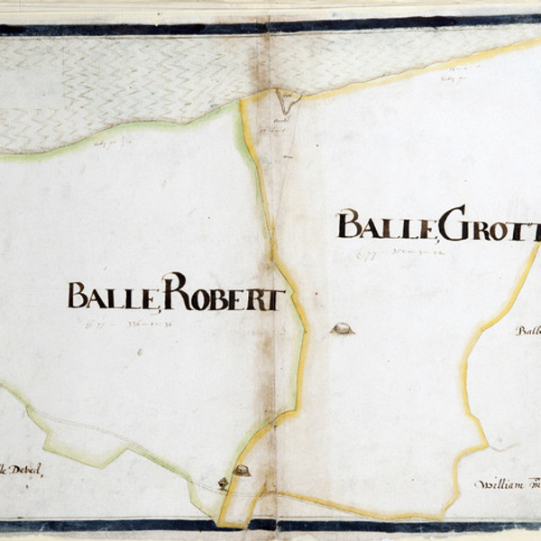
We are lucky that Frazer’s working map has survived, on which he drew convergent lines to highlight the ideal locations for vistas and peeps through the landscape. One of those points of convergence was just here, the perfect spot to build a seaside retreat.

In 1852 the decision was made to start the grand project, and soon new roads were under construction, and the avenue leading from Clandeboye house was started. 200 acres of farmland were purchased from tenant farmers,150 acres of new woods were planted, and the Duchess of Argyll laid the Grey Point foundation stone.[3]

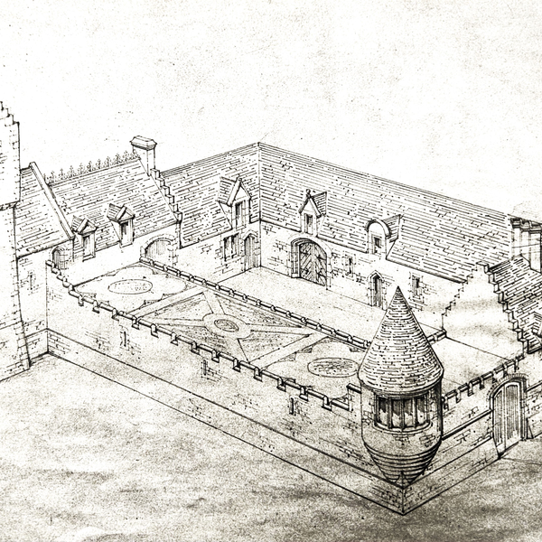
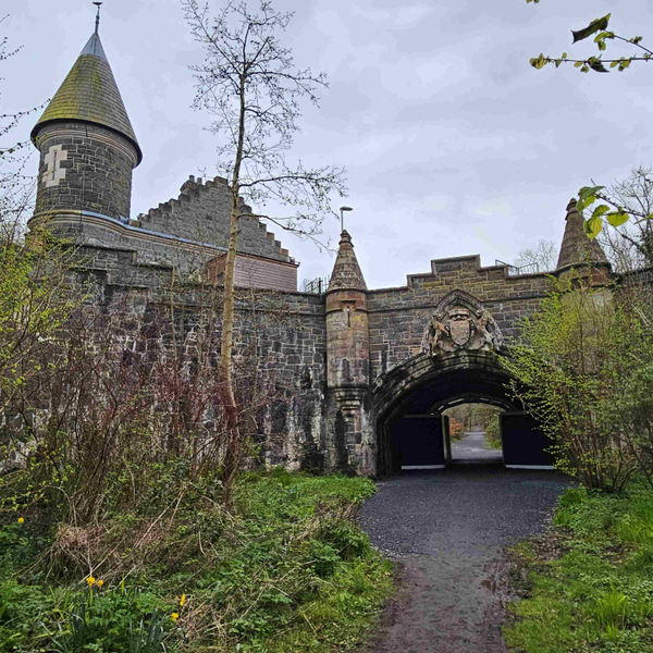
But then, horror, in November 1854 everything changed when the Coastguard Commander from Donaghadee contacted Dufferin’s land agent to enquire about building a lookout at Grey Point.[4] By 1857 maps had been produced showing the proposed site of a new coastguard station, just a few yards from here.[5] Undeterred, and despite his agent’s advice to cut his losses[6] , Dufferin was determined to press on with the Sea Park project. He employed Benjamin Ferrey, who also designed the magnificent Helen’s Bay station, to locate and design a Scottish Baronial style house somewhere within the Sea Park out of view of the coastguard station. Ferrey even wrote to Dufferin in 1861 to say that he had erected ladders against trees for him to climb and see the views from suitable sites.[7] But, with Dufferin’s financial constraints and the intrusion of the coastguards, Ferrey never did get his commission.

[1] Lyall, The life of the Marquis of Dufferin and Ava, 83

[2] PRONI D1071/H/V/1/8 (31 August 1853)

[3] PRONI D1071/A/K/1/B/3/1 (24 November 1854)

[4] PRONI D1071/A/K/1/B/6/1 (11 February 1857)

[5] PRONI D1071/A/K/1/B/6/1 (20 February 1857)

[6] PRONI D1071/A/K/3/B/2/1 (November 1861)

[7] PRONI D1071/A/K/3/B/2/1 (November 1861)

1 sound

The Coastguard Station

I’m sure that Lord Dufferin would not have been pleased when, in November 1854, he received a letter from his land agent to say that the local Coastguard commander had contacted him about locating a lookout on Clandeboye land at Grey Point.[1] By 1857, maps were drawn up that also included the coastguard station that looks over us now, and some land along the coast at Grey Point that was ‘probably’ required for a battery.[2]

Dufferin’s agent was understandably concerned about this development, especially as he was currently carrying out Lord Dufferin’s plans to create a landscaped Sea Park along this stretch of coastline. He was hoping that the authorities did not have the power to enforce compliance with their request for the proposed sea defenses,[3] but with the introduction of the Coast-Guard Service Act in 1856, the coastguard authority was passed over to the admiralty, who were given powers of compulsory purchase. So, nothing could be done to prevent it.

The location of the coastguard station was no doubt linked to this inlet, where the boat house and jetty were built. However, this was probably also one of the reasons why Lord Dufferin had been thinking about developing the site for his own use, with a seaside residence nearby. He was a keen and intrepid sailor, having ventured into the Baltic in 1854 and as far North as Spitzbergen in 1856 in his yacht the ‘Foam’,[4] and this would have been a perfect site for a little harbour.

As for the building, Lord Dufferin appears to have taken an instant dislike to the design and asked his architect, Benjamin Ferrey, to do something about it. Ferrey wrote that he would try to devise some plan to take away the appearance of the large and small gables “to which your Lordship objects”.[5] I’m not sure that he succeeded.

The location of the coastguard station in his Sea Park would remain forever a thorn in Dufferin’s side. Even years later, in 1888, he was obviously still enraged when he wrote to his then agent “What on earth do they want a new house at the coastguard station for? Try to induce them to leave it alone. At present the boat house is an eyesore, and the new one with its vulgar architecture will spoil the appearance of the whole neighbourhood.”[6]

Whatever the outcome of that spat, the damage was probably done many years earlier when the building above us, with its dragon’s teeth gables, precipitated the abandonment of the costly sea park project in favour of the more lucrative development of Helen’s Bay village. Lord Dufferin’s diary entry in 1855 even notes that he “Rode to Grey Point and discussed with Thompson [his agent] the advisability of getting up a bathing town there”.[7]

[1] PRONI D1071/A/K/1/B/3/1 (24 November 1854)

[2] PRONI D1071/A/K/1/B/6/1 (11 February 1857)

[3] PRONI D1071/A/K/1/B/6/1 (11 February 1857)

[4] Lord Dufferin, Letters from high latitudes, ed. John Murray (1856)

[5] PRONI D1071/A/K/3/B/2/1 (November 1861)

[6] PRONI D1071/A/K/1/C/12/1 (4 April 1888)

[7] PRONI D1071/H/V/1/11 (18 September 1855)

1 sound

Yachting

The earliest evidence of Lord Dufferin’s attraction to water was Lady Wantage’s recollection of him in Venice in 1851, “when he and Lord Gifford appeared on the Grand Canal in a small India-rubber boat, or rather tub, which freak on the part of the two mad young Englishmen caused much excitement among the people, accustomed to the calm dignity of gondolas.”[1]

Three years later Dufferin’s bravado extended to a voyage in his yacht the ‘Foam’ to the Baltic, where the English and French fleets were bombarding the Russian fort at Bomarsund, in the Aalund Islands. His escapades under fire are legendary as, in the words of Lyall, his biographer: “Like many imaginative men, he was evidently anxious to try the effect of inoculation with the war-fever, to test himself in situations that string up human energies to their highest tone, to witness the reality of what everyone reads about, and to feel the sensation of being actually under fire.”[2]

The next year he cancelled a trip to the Crimea when he fell ill. However, he made up for lost time in 1856 by setting sail for Spitzbergen, just 10 degrees short of the North Pole. His first landfall after Stornoway was Iceland, where he visited the Geysers, partied with Prince Napoleon, and captivated the Icelandic ladies.

From Reykjavik he sailed in search of the mountainous dot on the chart called Jan Mayen Island. He was beset in an icy still calm by fog and ice, but eventually “the roof of grey suddenly split asunder, and I beheld the gap – thousands of feet overhead, as if suspended in the crystal sky- a cone of illuminated snow.”[3] After much maneuvering through the ice they finally reached the shore where they landed, carrying their discarded figure head, which he had replaced with Marochetti’s bronze of the Duchess of Argyll whilst in Stornoway, a white ensign, a flag-staff and a tin biscuit box containing a list of the crew and the name of the yacht. These they hauled up the mountainside where “having tied the tin box round her neck, and duly planted the white ensign of St George beside her, we left the superseded damsel, somewhat grimly smiling across the frozen ocean at her feet, until some Bacchus of a bear should come to relieve the loneliness of my wooden Ariadne.”[4]

Dufferin’s book ‘Letters from High Latitudes’, from which this passage was quoted, was a best seller. It is still in print and a joy to read. He even presented the queen with a copy, bound in driftwood from Spitzbergen.[5]

[1] Sir Alfred Lyall, The life of the Marquis of Dufferin and Ava (London: Thomas Nelson & Sons, 1905), 75. [2] Lyall, The life of the Marquis of Dufferin and Ava, 87. [3] Lord Dufferin, Letters from high latitudes, ed. John Murray (1856), 121. [4] Dufferin, Letters from high latitudes, 126. [5] PRONI D1071/H/V/1/14 (27 August 1857)

1 sound

Grey Point Fort

Lord Dufferin had a fascination with all things Scottish and was determined to build a baronial style fortress on his estate, overlooking Belfast Lough. A suitable location, further along the coast to the west, was proposed by landscape designer James Frazer in 1852 but was foiled by the admiralty when they earmarked the site to build the Coastguard Station. Dufferin then turned to this location, which was less sheltered than the original site, but perhaps more prominent for a grand house, so it looked promising. But when in 1857 the admiralty finally produced a map showing the site for the proposed coastguard station, they also included a site ‘probably required for a battery’.[1] That site was just here, where the battery now stands. But do not jump to conclusions, because the structure beside us was not completed until 50 years later, in1907. In fact, Lord Dufferin noted in his diary in 1901 that “After lunch went to Grey Point to meet the Duke of Connaught who had come to inspect the proposed new fort”.[2]

Bearing in mind that he had already lost his ideal site to the coastguards, Lord Dufferin must have decided to steal a march on them here, and as, by 1865, there had still been no further movement from the admiralty, he commissioned his architect, William Lynn, to produce plans for a grand baronial mansion in the style of a Scottish fortress – right on top of the proposed battery site[3] . This was not to be a retreat by the sea, but a total replacement for Clandeboye House itself. He had never really liked Clandeboye house and had had plans drawn to restyle it as a Jacobean mansion[4] , as well as contemplating its demolition it and replacement on the hill overlooking the present-day courtyard. It would certainly have suited his character to relocate to the coast, where he could easily sail across to Inverary to visit his dear friends, the Argylls.

However, none of these projects ever came to fruition. Lord Dufferin borrowed huge sums of money to improve his estate and gradually came to realise that he would have to stay put in Clandeboye House, so he undertook minor improvements there and abandoned his grand plans.

In 1872 Dufferin was appointed Governor General of Canada, a role that finally enabled him to build on a grand scale and lead the lifestyle that he had yearned for, enlarging his two official residences, at Ottawa and Quebec to include ballrooms and even an indoor tennis court in Ottawa, which doubled up as a huge dining room. He was also able to commission William Lynn to join him in Quebec to rebuild the old battlements overlooking the St Lawrence River and design two new gates in the city walls, both very much in the style of Benjamin Ferrey’s railway arch at Helen’s Bay station, and all paid for by the Government.

So, in the end, Lord Dufferin got his mansions, albeit in Canada, Grey Point got its fort, Belfast Lough was defended, and everyone was (hopefully) happy.

[1] PRONI D1071/A/K/1/B1 (11 February 1857)

[2] PRONI D1071/H/V/32 (18 August 1901)

[3] PRONI T3020/39/1

[4] PRONI T3020/40

1 sound

Helen's Bay

Although, in 1855, Lord Dufferin did not even own the beach or much of what is now the golf course, he was discussing with his agent the idea of creating a bathing town. There is even a painting, allegedly by him, of a grand Victorian town, viewed from the rocks below us, complete with a pier at the centre of the beach and a pleasure steamer lying alongside. The Presbyterian church on Church Road bears a strong resemblance to the style of buildings in the painting. It was inaugurated in October 1896 when Lady Dufferin laid a memorial stone.[1]

In 1862, Lord Dufferin purchased the beach and the far side of the land now occupied by the golf course, adding it to his Sea Park, and planting clumps of trees, which he later named after some of his favorite yachts, ‘Talisman’, ‘Chimera’ and ‘Erminia’. The ‘Erminia’ holds a little-known place in local history. Lord Dufferin purchased the yacht in 1857 with the intention of converting her into an auxiliary yacht by installing a steam engine. It must have been an impressive piece of engineering, for when the steam pressure was first raised the crew abandoned ship in fear.[2] However, sea trials were undertaken, and she was pronounced fit to carry Lord Dufferin, his mother, and friends on a voyage to the Mediterranean, visiting Egypt and venturing as far as Constantinople.

Before embarking on the voyage, Lord Dufferin sailed in the company of friends to Cherbourg for the unveiling of a statue to Napoleon 1st, followed by a ball. One of his guests was Helen Graham, better known by her friends as Nelly, and a very close friend of the young Dufferin – much to the displeasure of his mother.[3] On his return to England, he wrote in his diary that he had “Sent Nelly a picture of ‘Erminia’[and] called the bay at Grey Point Helen’s Bay after [her]”.[4] So, we may have been looking across to Nelly’s Bay, but he later crossed out the “her” in his dairy and replaced it with “my mother” who was also called Helen. Hence, Helen’s Bay is named after Lord Dufferin’s mother, and not his girlfriend.

The proposed location of the bathing town eventually became the Helen’s Bay golf course, which was opened in May 1896. Lord Dufferin was both landlord and patron and in the early years the caddies were the sons of Clandeboye Estate workers. His prowess is not known, but he did record a round in May 1897.[5] He also noted in his diary in October 1900 that he received a deputation from the members about building them a house.[6] The first club house was later described as a quaint old cottage. Also quaint would have been the flock of sheep employed to keep the grass under control. No wonder the highest score on the opening day was 168![7]

[1] PRONI D1071/H/V/1/33 (24 October 1896)

[2] PRONI D1071/H/V/1/15 (9 February 1858)

[3] Andrew Gailey, The Lost Imperialist (London: John Murray, 2015), 74.

[4] PRONI D1071/H/V/1/15 (25 August 1857)

[5] PRONI D1071/H/V/1/34 (2 May 1897)

[6] PRONI D1071/H/V/1/36 (22 October 1900)

[7] Twixt Bay & Burn, ed. R. Masefield (Bayburn Historical Society, 2011), 105.

1 sound

The road to the shore

The footprint of this popular car park lies on part of the three-mile avenue, laid out in 1850, that stretches from Clandeboye House to the shore at Helen’s Bay beach. If you cross Fort Road and carry straight on, along Grey Point, you will be walking along its final stretch to the shore.

Examination of the 1st Ordnance Survey map of 1834 reveals that this route predates the avenue and raises the question of when it was first built.[1]

This part of North Down was settled by James Hamilton during the plantation of Ulster and we are fortunate that, due to a dispute between him and Hugh Montgomery over their respective titles, Hamilton engaged Thomas Raven in 1626 to draw up maps of his lands.[2] The main features on the maps are the townlands; ancient administrative units of land, generally capable of then sustaining two families.[3] The road from Bangor, via Crawfordsburn, to Belfast is clearly marked on Raven’s map, but there is no sign of this one, so the road was almost certainly built after 1626. The fact that it is straight points towards the eighteenth-century, when funding for new roads carried a stipulation that they should be as straight as possible.

The townlands of Ballygrot and part of Ballyskelly were purchased in 1736 by the Blackwood family, and the title to the land was passed down through the generations to the fifteen-year-old Frederick, Lord Dufferin in 1841. But it was not until October 1850 that he engaged James Frazer, to improve the landscape of his newly renamed Clandeboye estate. One day they walked together to Grey Point and, as he wrote in his diary “Found that I was quite independent of the Crawfords [of Crawfordsburn] and that I possessed a mile of coast. Very glad of this”[4] . He immediately saw the potential of creating what he called his Sea Park complete with a mock fort, overlooking Belfast Lough. All that was required was an avenue from Clandeboye house.

This old road was an obvious candidate, so Frazer set about designing the avenue along its route, as well as laying out alternative roads to replace it, including the Craigdarragh and Bridge Roads.

Another part of Dufferin’s evolving plan, especially with the coming of the railway in 1865, was to create a seaside village, or what he called a bathing town.[5] Although his fort did not materialise, at least Frazer’s landscape plan was completed, providing Helen’s Bay with the wooded coastal path, access to the open countryside along the avenue, and the golf course with its landscaped woodlands.

What would have been a large part of the Sea Park is now occupied by the houses on Grey Point and Sheridan Drive. Fortunately, a portion beyond them remained undeveloped and has become a naturally rewilded addition to the Crawfordsburn Country Park, no longer independent of the Crawfords.

[1] PRONI Historic map viewer

[2] On display in the North Down Museum, Bangor

[3] Jonathan Bardon, The Plantation of Ulster (Dublin: Gill & Macmillan, 2011), 115.

[4] PRONI D1071/H/V/1/5 (22 October 1850)

[5] PRONI D1071/H/V/1/11 (18 September 1855)

1 sound

Helen's Bay Station

In 1852, when Lord Dufferin devised his avenue from Clandeboye House to Grey Point, there was no thought of a railway along the coast from Holywood to Bangor. In fact, Lord Dufferin was then supporting the idea of a line from Belfast, via Newtownards to Donaghadee as part of his interest in promoting the Donaghadee to Portpatrick steam packet. His landscape architect, James Frazer, had even mapped out the route of the proposed railway line, complete with a road from Clandeboye to a station at Conlig.

The extension of the Belfast to Holywood line onwards to Bangor was first publicly mooted in 1858.[1] Lord Dufferin was not very enthusiastic about the project, as the line would cross his land and new avenue, obscuring his view of the Sea Park and Belfast Lough beyond.

Despite this, work on the line started in 1862 and, at a grand dinner commemorating the laying of the foundation stone of the Crawfordsburn viaduct, Lord Dufferin admitted that the support supplied by some of the other landowners along the line had been “more thorough and more enthusiastic” than his own.[2]

However, there was perhaps a silver lining. Having been foiled by the Coastguards in his attempt to build a grand Scottish baronial style house on the coast, and running short of funds due to his excessive expenditure on road building and other estate improvements, here was a chance to finally build his Walter Scott inspired folly, at someone else’s expense. He duly commissioned Benjamin Ferrey to design this wonderful station, complete with crow step gables, a tower, and down below the huge coat of arms on the face of the railway bridge, opening out into the carriage turning circle and the now bricked up door that led up steps to his private waiting room.

There were nervous moments for Ferrey as the middleman in the enterprise, evidenced by his letter to Lord Dufferin’s secretary in January 1864 that he was worried about payment from the railway company.[3] However, work progressed, and the roof was finally slated in February 1865. But then Dufferin discovered that the architect and engineer for the project, Charles Lanyon intended to name it Crawfordsburn Station. This idea was nipped in the bud with a letter from his land agent to Lanyon asking for it to be changed to Clandeboye Station. [4]

By 1894 the route was so busy that the railway company was planning to expand the line from one to two tracks. This entailed a new platform, complete with an underpass.[5] Dufferin’s land agent asked if an opening could be made onto the avenue at the same time, maybe to provide access for passengers along the avenue to the new village, after which it was renamed Helen’s Bay Station in 1895. And so it endures: a symbol of Lord Dufferin’s romantic vision and a genuine jewel of the Victorian period.

[1] The Downpatrick Recorder 30 October 1858

[2] Masefield. Robin, 'Be Careful, Don't Rush' (Bayburn Historical Society, 2015), 44.

[3] PRONI D1071/A/K/3/B/2/1 13 January 1864

[4] PRONI D1071/A/K/3/B/15/1 24 February 1865

[5] PRONI D1071/A/K/1/C/18/1 17 April 1894

1 sound

DOWNLOAD OUR APP TO DISCOVER THIS TOUR AND MANY OTHERS.

play-storeapp-store

Or start creating tours, treasure hunts, POI maps... Just let your imagination guide you.


Other walks nearby


Are you a creator?

START HERE

Privacy & cookie policy / Terms and conditions

© ECHOES. All rights reserved / ECHOES.XYZ Limited is a company registered in England and Wales, Registered office at Merston Common Cottage, Merston, Chichester, West Sussex, PO20 1BE

v2.5.15 © ECHOES. All rights reserved.