Helen's Tower Lake
1 sound
Although we are surrounded by woodland, this was not the case at the time of the plantation in the seventeenth century, and any that did remain was closely guarded by the Earl of Clanbrassil. However, there was plenty of peat for the tenants to dig and dry for fuel, and provision was made in leases to keep open the tracks to the bogs, or mosses as they were known. For example, in a lease to William Crafford in 1674 there was a covenant protecting “all royalties especially the waies leading to the mosses of Ballyleidy and Bangor”.[1]
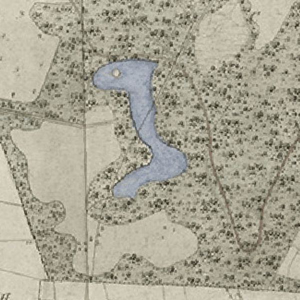
You may have noticed that the water on either side of this causeway looks black. This is probably because the lakebed is composed of peat, which would confirm that it was once one of the mosses of Ballyleidy, long since dug out; but dug out by whom? Certainly, at the time of the first Ordnance Survey map in 1834 this area was shown as moss land, in fact it is still known by estate staff as “the moss”. However, an estate map of 1862 shows this to be a lake, but without this causeway across it.
It is well documented that Lord Dufferin created the lake in front of Clandeboye house both as a landscape feature and as a means of diverting the main road around his estate.[2] Perhaps this lake was initially created for the same reasons. In his landscape map of 1852, James Frazer drew what might have been a square lake on the southern side of the causeway but did not interfere with this road. In the same vein, Frazer, when drawing the potential lake at the house, also drew a road to pass around it. So, it looks as though Dufferin had other ideas, sometime after Frazer had completed his work. This is backed up by a hand-coloured estate map of about 1862 which depicts this lake with no causeway. However, all subsequent maps show the causeway.
The supposed conclusion is therefore that Dufferin was not successful in closing this road and was forced to reinstate this earlier roden or bog road, to allow passage to this and other mosses in the vicinity. Although there is no later evidence of turf digging, or turbary as it was known, the lake and causeway may have been used for military training during the First World War, as there are the feint marks of trenches in the woods nearby, where I once found a pig tailed spike, as used to string up barbed wire in no-man’s land in Flanders.
Although still marked on maps, the causeway gradually grew over and became impassible, until 1983, when it was reinstated and now forms part of the Columban way that runs from Bangor, through the estate from Helen’s Bay to Helen’s Tower and onwards towards Newtownards and Comber.[3]
[1] Margaret Garner, "North Down as displayed in the Clanbrassil Lease and Rent Book," Belfast Natural History and Philosophical Society: 35.
[2] PRONI D1071/A/K/1/B/14/1 (9 March 1865)
[3] https://www.visitardsandnorthdown.com/explore/heritage-trails/columban-way-heritage-trail
