Obelisk
1 sound
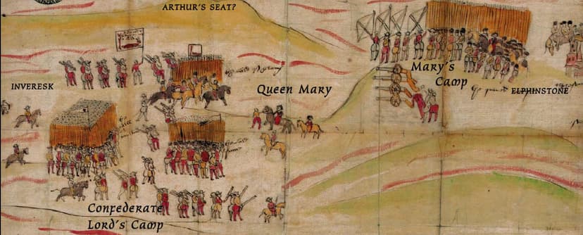
This illustrative map was sent by an unknown informant accompanying the Confederate Lords, to William Cecil, Lord Burleigh, Queen Elizabeth's great statesman. It is now in the UK state archives. In this view, Carberry Hill is seen from Cousland. The image shows the positions occupied by the two forces, and also depicts Mary's act of surrender.
Negotiations lasting all day finally reached an agreement that Bothwell would fight in single combat, initially with Lord Lindsay. This would have inevitably led to his death, and at the last minute, Mary forbade the fight. She knew that she was already carrying his child (she miscarried twins some weeks later, during her imprisonment in Lochleven Castle).
Cecil had taken a keen interest in Scottish affairs from the time he was a legal official with the English invading army in 1547. He was a determined opponent to Mary, and a strong advocate of her execution.
