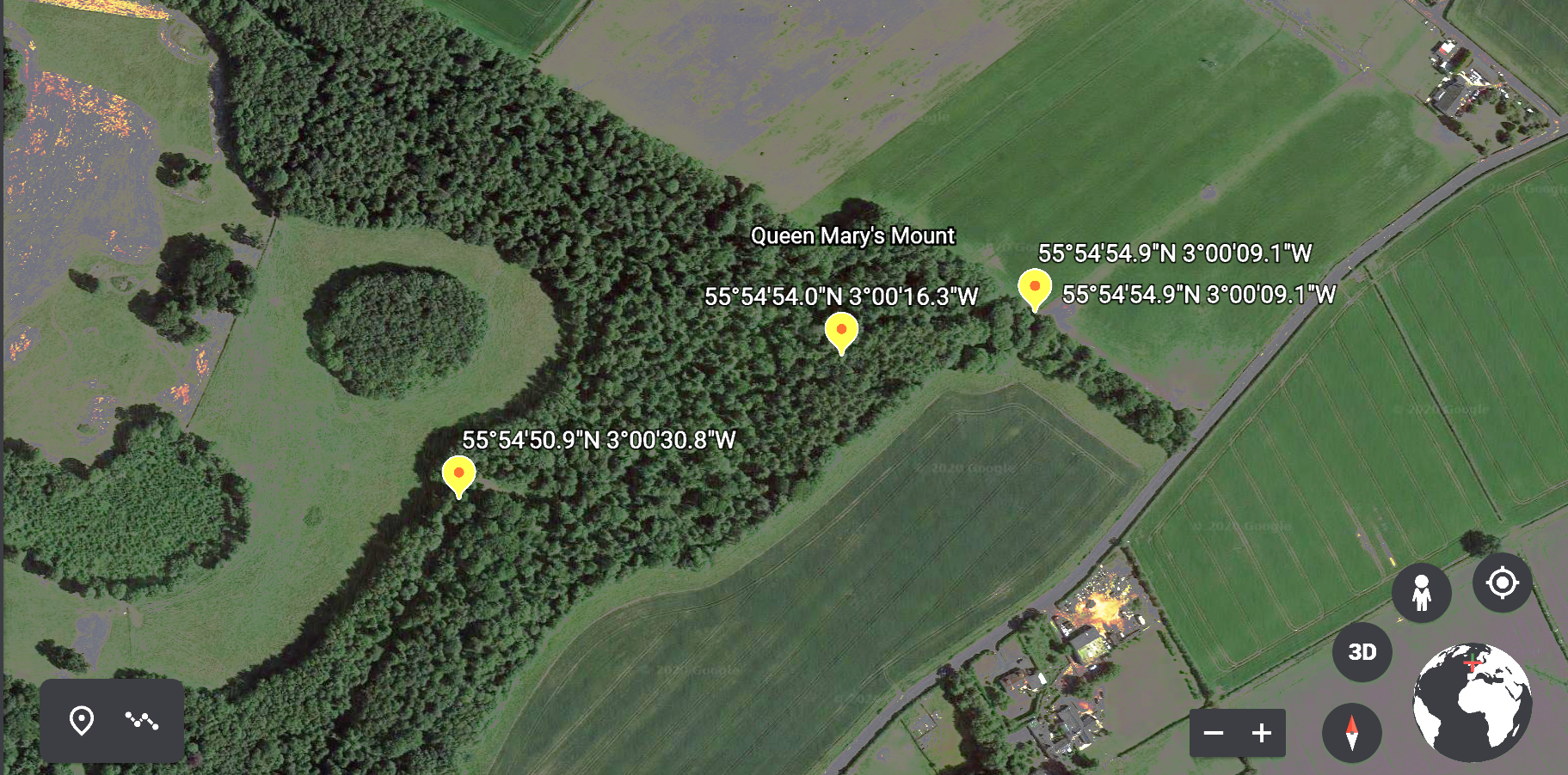
Queen Mary's Mount
4 ECHOES
Location: Musselburgh
Come and enjoy a woodland walk through history!
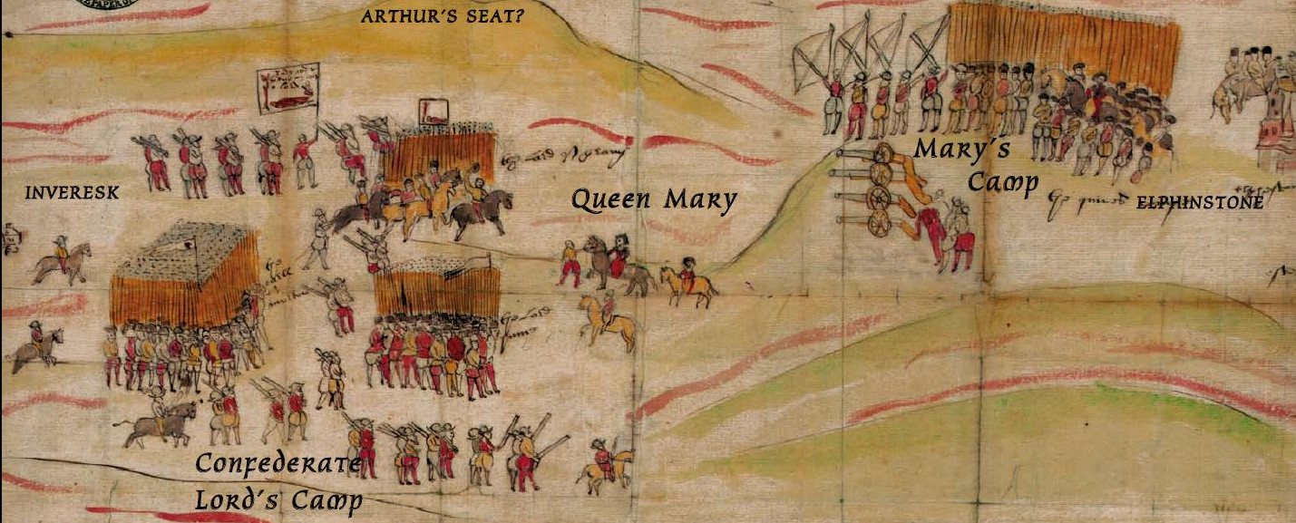
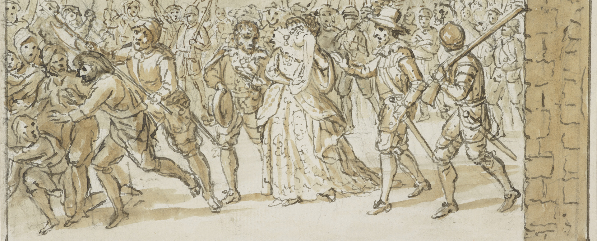
Queen Mary's Mount, near Carberry, was the site of the armed confrontation that ended the reign of Mary Queen of Scots, on 15 June, 1567.
Follow this Echo, and I'll tell you all about it.
Download the Echo at home, and then look for the way into the woods on the B6414 road between Crossgatehall and Elphinstone. Start the Echo there and it will help you to find it.
It can be quite muddy in these woods after rain, so you should wear appropriate footwear........
Carberry Hill, once the home of the Elphinstone family, is now managed by the Buccleuch Estate.
The images, on the cover of this Collection, are of Mary, with Lord Bothwell on the right. On the left is a medallion celebrating her marriage to Lord Darnley.
All these images are reproduced by permission of the Scottish National Portrait Gallery.