Ancient Woodland
1 sound
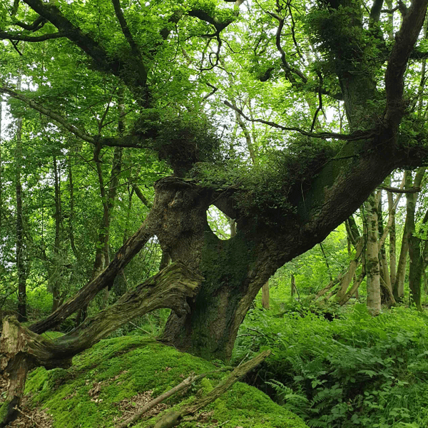
We are currently standing in the only woodland in North Down that is classified as ancient, because it has been here continuously since 1600. This ancient woodland also extends along the entrance route into the Blackwood Golf Course. The total area is just over 10 acres, or 1% of the estate’s total woodland. This compares with 0.4% ancient woodland cover for the whole of Northern Ireland and 2.5% for the UK.
We know that this is ancient because it was marked on Thomas Raven’s 1626 map of the Hamilton Estates. The woodland marked on Raven’s map also extended all the way from the Crawfordsburn Road to the Cairn Wood, but even though it is wooded now, because much of it was not marked on the 1834 map it does not classify as ancient. The Woodland Trust have recently undertaken an ancient woodland inventory, which can be viewed on their interactive map.[1]
The woods that stretch from the Crawfordsburn road to the point where the footpath turns towards the Ballysallagh road were sketched in detail on James Frazer’s working map in 1852. He also traced an outline for the Cairn Wood, which Dufferin acquired and started planting in 1857.[2] Dufferin then decided to connect this woodland to the Cairn wood, thus creating a continuous woodland belt that ran the entire length of this Southeastern boundary of the estate.[3]
A later map of the estate has a pencil line showing the proposed Ladies Drive; a new route that Dufferin was planning to the Cairn Hill. There is also a letter to his agent in January 1888 with instructions to “Take it through the wood in such a way as to conceal the narrowness of the plantation as much as possible and to allow it to be near the northern edge whenever the view across the fields to the lough is pretty. It then ought to go right around the Cairn Hill. My object is to have a new and pleasant additional ride of three or four miles in my own ground without having to cross a road or open a gate.' To keep it dry, create open drains on either side. It should be kept as it were in the grounds but giving views out of them.”[4]
By 1894 Dufferin was even considering a tunnel under the Crawfordsburn road “so as to get into the ‘Ladies Drive’ without opening the gates.” Although that did not materialise, in 1899 he was still absorbed in the project and attempting to find an easier carriage access to the Cairn Wood, even to the extent of determining whether or not to buy an adjoining farm.[6]
Over the early decades of the twentieth century, the drive gradually grew over and was forgotten. However, in 1983, and with no knowledge of its previous existence, plans were drawn up to create a new footpath along the same route as part of the Ulster Way, which gives so much pleasure to this day.
[1] ati.woodlandtrust.org.uk/back-on-the-map/
[2] PRONI D1071/A/K/1/B/6/1 (12 January 1857)
[3] PRONI D1071/A/K/1/B/6/1 (6 February 1857)
[4] PRONI D1071/A/K/01/C/12/1 (21 January 1888)
[5] PRONI D1071/H/V/1/31 (11 September 1894)
[6] PRONI D1071/H/V/1/34 (23 January 1899)
