Chronicles - Walk 4

3 ECHOES

Location: Newtownards, Ards and North Down, Northern Ireland, United Kingdom

John Witchell
John Witchell

This section links the Clandeboye Avenue (Walk 3) with the Crawfordsburn Road, where there is a place to park on the side of the road. The route is 1.3 miles, mainly throgh woodland along the periphery of the Blackwood Golf Course. There is also a short link up to the Ballybarnes Road.

Soundtrack: Orchestral Scherzo by Daniel Williams

Ballysallagh Minor

In this furthest southern corner of the townland of Ballysallagh Minor a small, thatched cottage once stood in a woodland clearing. Thomas Raven marked it on his map of the Hamilton estates in 1626 and drew it in the style of an Irish cabin, without even a chimney. The townland was then occupied by Mr Sander (as in Alexander) Cuningham.[1] His house was about one and a half miles downstream from here, on the far side of the Ballysallagh Road. The house, as drawn by Raven, was stone built with two windows on either side of a central front door and first floor dormer windows. Although the house is long gone, a clump of trees once marked the site, although it too has now disappeared under the plough.

Attempts by Queen Elizabeth in the 1570s to push the O’Neill clan out of this part of Ulster through plantation by Sir Thomas Smith had proved disastrous, resulting in scorched earth tactics by O’Neill and ensuing English retribution. The result was that for the following thirty years, until the Hamilton plantation began in 1606, the land was depopulated, wasted and desolate. So Cuningham could have been the first person for over thirty years to occupy the townland, except maybe for the occupants of the Irish cabin.

Alexander Cunningham had purchased the land from Sir James Hamilton on 28th November 1615. The area was noted as 12 score and 12 acres after the usual measure of Scotland, which would equate to about 320 acres today, and the rent was £8 current money of England.[2]

The next recorded transaction included the purchase of Ballywooly, Ballygrott, Ballyskelly and Ballysallagh by the Blackwood family in 1726, as they began to extend their estate.[3] The Blackwoods had purchased the adjoining townland of Ballyleidy in 1674 and constructed their own plantation style house, complete with an avenue leading up from the main road; so maybe the Cuningham house was surplus to requirements, demolished and the stone used for other building projects. This was common practice, but it is ironic that the cabin that stood here remained until at least 1834, out of sight and out of mind.

By the 1850s, when James Frazer began designing the extensive new landscape, it finally succumbed when Lord Dufferin decided in 1857 to join this woodland to the Cairn wood, thus creating a continuous belt of woodland along the southern boundary of his estate that linked the two hill tops dominated by Helen’s Tower at one end and the ancient hill fort of Cairngavar at the other.[4] Certainly, at that time, Lord Dufferin was quite used to demolishing cottages on the estate, in the name of progress.[5] And maybe it was a little past its best after two centuries of habitation.

[1] Raven Map 1626, on display in the North Down Museum [2] Landed Estates Court. Estate of Earl of Dufferin. Statement as to Titles to land comprised in conditional order for declaration of title (privately held) [3] ibid [4] PRONI D1071/A/K/1/B/6/1 (6 February 1857) [5] PRONI D1071/A/K/1/B/6/1 (22 May 1857)

1 sound

The Warren

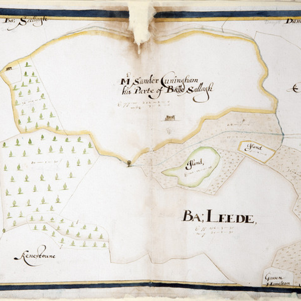
Here we are walking alongside the Blackwood Golf course. If you can find a spot to see out onto the course, you might think that the varied landscape is ideal for tricky fairways. On the other hand, as a farmer a couple of hundred years ago you might have thought differently. This area of about 50 acres was once split up into fifteen small fields and would have been hard graft for any ploughman. Perhaps that is why it was turned to grazing and became known as the Sheep Walk. This is the upper Sheep Walk, the Lower Sheep Walk being the far side of the entrance to the course, running down to the corner opposite the Clandeboye dairy farm. The Lower Sheep Walk is on better land, with bigger fields, but Lord Dufferin had other plans for the Upper Sheep Walk.

In the archive there are numerous references to game management. There was a pheasant shoot on the estate, but Lord Dufferin was also keen on rabbit shooting, to the extent that in 1899 he converted the Old Deer Park, which now forms part of the Clandeboye Golf Course, near Conlig, into a rabbit warren. He even introduced 100 rabbits that were shipped over from the Netherby Estate, near Carlisle.[1] But one rabbit warren was not enough, as he had also decided to convert the Upper Sheep Walk into a second warren.[2] Rabbit numbers must have grown considerably as, by the end of the next year, a day’s shooting yielded 201 rabbits in the Deer Park and another 221 in the Warren.[3]

Since then, this area was always known as the Warren, that is, until it became the par 3 golf course, although still with its fair share of rabbits. When the fairways were laid out, special care was taken to preserve as many of the rough areas as possible to protect its varied flora.

At almost the same time that he was creating the Warren, Dufferin was also turning his attention to a water supply for Clandeboye house, and was out there looking for a site for a reservoir.[4] He also invited Colonel Sharman Crawford to see where the water was being collected to show that he was not infringing on his rights downstream in Crawfordsburn.[5] Later that year he was faced with a deputation from the inhabitants of Helen’s Bay, who also wanted water from the new reservoir.[6] Maybe this increase in demand was why a second, bigger reservoir was later built on the far side of the Crawfordsburn Road.

Today, now that all houses are supplied with good drinking water, the reservoirs have important new uses: The Warren reservoir is used for watering the greens on the golf course and the second reservoir supplies water to the dairy cows whose milk is made into Clandeboye’s famous yoghurt.

[1] PRONI D1071/H/V/1/34 (15 February 1899)

[2] PRONI D1071/H/V/1/34 (2 February 1899)

[3] PRONI D1071/H/V/1/34 (6 December 1900)

[4] PRONI D1071/H/V/1/34 (7 June 1899)

[5] PRONI D1071/H/V/1/34 (28 April 1899)

[6] PRONI D1071/H/V/1/34 (11 October 1899)

1 sound

Ancient Woodland

We are currently standing in the only woodland in North Down that is classified as ancient, because it has been here continuously since 1600. This ancient woodland also extends along the entrance route into the Blackwood Golf Course. The total area is just over 10 acres, or 1% of the estate’s total woodland. This compares with 0.4% ancient woodland cover for the whole of Northern Ireland and 2.5% for the UK.

We know that this is ancient because it was marked on Thomas Raven’s 1626 map of the Hamilton Estates. The woodland marked on Raven’s map also extended all the way from the Crawfordsburn Road to the Cairn Wood, but even though it is wooded now, because much of it was not marked on the 1834 map it does not classify as ancient. The Woodland Trust have recently undertaken an ancient woodland inventory, which can be viewed on their interactive map.[1]

The woods that stretch from the Crawfordsburn road to the point where the footpath turns towards the Ballysallagh road were sketched in detail on James Frazer’s working map in 1852. He also traced an outline for the Cairn Wood, which Dufferin acquired and started planting in 1857.[2] Dufferin then decided to connect this woodland to the Cairn wood, thus creating a continuous woodland belt that ran the entire length of this Southeastern boundary of the estate.[3]

A later map of the estate has a pencil line showing the proposed Ladies Drive; a new route that Dufferin was planning to the Cairn Hill. There is also a letter to his agent in January 1888 with instructions to “Take it through the wood in such a way as to conceal the narrowness of the plantation as much as possible and to allow it to be near the northern edge whenever the view across the fields to the lough is pretty. It then ought to go right around the Cairn Hill. My object is to have a new and pleasant additional ride of three or four miles in my own ground without having to cross a road or open a gate.' To keep it dry, create open drains on either side. It should be kept as it were in the grounds but giving views out of them.”[4]

By 1894 Dufferin was even considering a tunnel under the Crawfordsburn road “so as to get into the ‘Ladies Drive’ without opening the gates.” Although that did not materialise, in 1899 he was still absorbed in the project and attempting to find an easier carriage access to the Cairn Wood, even to the extent of determining whether or not to buy an adjoining farm.[6]

Over the early decades of the twentieth century, the drive gradually grew over and was forgotten. However, in 1983, and with no knowledge of its previous existence, plans were drawn up to create a new footpath along the same route as part of the Ulster Way, which gives so much pleasure to this day.

[1] ati.woodlandtrust.org.uk/back-on-the-map/

[2] PRONI D1071/A/K/1/B/6/1 (12 January 1857)

[3] PRONI D1071/A/K/1/B/6/1 (6 February 1857)

[4] PRONI D1071/A/K/01/C/12/1 (21 January 1888)

[5] PRONI D1071/H/V/1/31 (11 September 1894)

[6] PRONI D1071/H/V/1/34 (23 January 1899)

1 sound

DOWNLOAD OUR APP TO DISCOVER THIS TOUR AND MANY OTHERS.

play-storeapp-store

Or start creating tours, treasure hunts, POI maps... Just let your imagination guide you.


Other walks nearby


Are you a creator?

START HERE

Privacy & cookie policy / Terms and conditions

© ECHOES. All rights reserved / ECHOES.XYZ Limited is a company registered in England and Wales, Registered office at Merston Common Cottage, Merston, Chichester, West Sussex, PO20 1BE

v2.5.15 © ECHOES. All rights reserved.