If Elora Could Talk

11 ECHOES

Location: Elora, Ontario, Canada

Township of Centre Wellington, Planning Department

What stories would Elora tell if it could talk?

Every street, neighbourhood, and gathering place has a story to tell. Join this self-guided walking tour to discover how the community has grown and changed over time, and how thoughtful planning helps shape the places we know and love.

Created in celebration of World Town Planning Day, If Elora Could Talk invites you to explore Elora through a different lens. Along the way, discover the connections between housing, heritage, natural spaces, community life, and the planning decisions that help shape our shared future.

Whether you've called Elora home for years or are exploring it for the first time, this tour offers an opportunity to slow down, look around, and discover the stories behind the places that make Elora so special.

1 MacDonald Square

Welcome to Elora. Before we begin, we acknowledge that the lands we know today as the Township of Centre Wellington have been home to Indigenous Peoples since time immemorial. We acknowledge that we are on the treaty lands and traditional territory of the Anishinaabe and the Haudenosaunee.

With increasing encroachment by non-Indigenous settlers in the Township of Centre Wellington, the Anishinaabe and Haudenosaunee could not continue their traditional lifestyle and settled in their villages along the Credit River and in the Grand River Valley. These Indigenous Nations uphold their Treaty Rights within our jurisdiction.

Today, the Township of Centre Wellington remains home to Indigenous Peoples from across Turtle Island. We are grateful to have the opportunity to share and respect Mother Earth and are committed to building constructive and cooperative relationships with Indigenous Nations.

As we spend some time thinking about how this community has been shaped, we do so with respect for the people, relationships, and histories that came long before the streets and buildings we will encounter along the way.

This tour was created in recognition of World Town Planning Day. A chance to explore some of the decisions, ideas, and changes that have shaped Elora, and continue to do so to this day. And this seems like the perfect place to begin.

--

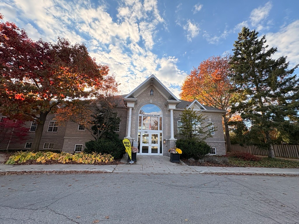
You’ve probably come here to pay a bill, attend a meeting, cast a ballot, ask a question, or maybe just to use the parking lot.

I’ve been part of Elora’s civic life in one form or another for much longer than my current name suggests. In the nineteenth century, this part of Elora was known as Market Square. A large brick market hall was built nearby in 1874. Farmers and merchants came here to do business; there were produce and butcher stalls inside, a grain buyer's office, and even municipal weigh scales nearby for livestock and loads of grain. Over time, the building became better known as Elora's Town Hall. So, people have been coming to this area to trade, gather, and make community decisions for roughly 150 years.

The Civic Centre you see today opened in 1994. And here's a detail that catches people sometimes: MacDonald Square isn't named for Canada's first prime minister. It honours Jack MacDonald, whose family's charitable fund helped establish the new municipal building. The road in front of it was given his name when the building opened.

Five years later, the municipal map changed again. In 1999, Elora joined Fergus and the former townships of Nichol, Pilkington, West Garafraxa, and part of Eramosa to form the Township of Centre Wellington. But the map has been changing for much longer than that.

The Village of Elora was first surveyed in 1832, close to the falls of the Grand River. Early accounts point to several reasons for the location: fertile surrounding farmland, water power for mills, and even the scenery. Those early choices are still readable in the community around you. So are the choices being made today.

The location of streets, relationship between buildings and sidewalks, mix of shops and homes, places set aside for public use, and buildings that have been kept, adapted, or replaced all tell part of Elora’s planning story. Some of these decisions were made generations ago. Others are much more recent.

From here, we’re going to leave the Civic Centre and start looking at how those decisions show up on the ground. For our first example, make your way north across Colborne Street towards 175 Geddes Street, one of the newer additions to part of downtown. As you walk, pay attention to the buildings around you. Notice how close they sit to the street, what happens at the ground floor, and where people live in relation to the shops and services below.


1 sound

175 Geddes Street

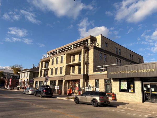
I’m one of the newest buildings you’ll meet on this walk. Take a moment to look at all that’s happening within my relatively small piece of downtown land. At street level, I have space for shops and services, and above I have 18 purpose-built rental apartments.

In planning, adding a new development within an already built-up part of a community is called infill. When that new development allows an existing area to accommodate more homes, businesses, or activity, you’ll often hear another planning term, called intensification. Here, both are happening at once. Infill and intensification are important for creating new homes and opportunities for people within existing built-up areas, while helping reduce pressure on surrounding agricultural lands and important natural spaces.

The combination of both homes and commercial space in the same building has another name; mixed-use development. Mixed-use is something you’ll see throughout older downtowns, even if nobody called it that when the buildings were constructed. This allows me to be incredibly efficient; to be a place where people can live and work at the same time. For generations, main streets have included shops, offices, and services at the street level, with people living in apartments above them. That mix puts different parts of daily life close together and helps keep a downtown active beyond any single use or time of day.

My apartments also add something quite specific, called purpose-built rental housing. Purpose-built rentals are designed and constructed specifically as rental homes. They form part of the community’s long-term rental housing supply and can provide another option for people who may not want, need, or be ready to own a home.

Now, look at how I meet the street. My commercial units face Geddes Street, with entrances and large windows along the sidewalk. Residential uses are above, while vehicle access and much of the parking are located toward the rear of the property. These details are what allow the commercial part of the building that most people experience while walking along Geddes Street to remain connected to the sidewalk and the activity of the downtown.

Although I am new, the basic idea behind me is deeply familiar in a place like Elora. People living close to shops and services, different uses sharing the same property, and buildings contributing actively to the public realm.

Downtowns have always changed as the needs of the people using them change. Sometimes that happens through a new building like me. A few steps away to the north, you’ll find an older heritage building circa 1867 at 195 Geddes Street that has adapted again and again without leaving its corner. It is known to the community as “the Connon Block” because it is associated with Thomas Connon, and his son John Robert Connon, notable local photographers and historians, whose studio was situated on the upper floor of the building. Continue towards 143 Metcalfe Street. Its story shows another way a downtown can evolve.

1 sound

143 Metcalfe Street

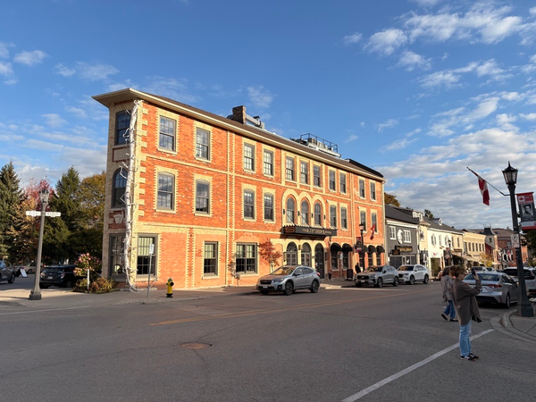
I've been standing at this corner since 1865, which has given me plenty of time to change my mind about what I want to be. I began as the Dalby House, one of Elora's major hotels.

In those days, a hotel could be much more than a place to spend the night. Robert Dalby also operated stagecoach routes from here, connecting Elora with Guelph, Fergus, and communities farther north and west. Across Geddes Street stood my stone stable, where horses, coaches, and travellers came and went. I was part accommodation, part transportation hub, part meeting place, and part business centre. And man, was I busy!

Over the years, spaces within my walls have been used for a remarkable variety of purposes. I've housed a hardware store, barber shop, offices, photography studio, medical services, shops, and homes. For a time, my upper floors contained apartments with retail space below. More recently, I've returned to accommodation use, bringing one of my earliest functions back into the building.

In planning, you'll sometimes hear the term adaptive reuse. It describes giving an existing building a new purpose while continuing to use the building itself. That can be especially valuable in an established downtown. Reusing a building can conserve materials and embodied energy, maintain the shape and character of a streetscape, and allow a property to respond to new economic and community needs without starting again from an empty lot.

My unusual shape has helped make me recognizable for generations. Look at the narrow point where Geddes and Metcalfe meet. The building follows the geometry of the streets around it rather than sitting on a conventional rectangular footprint. This triangularly shaped building is typically called a “Flatiron Building”.

And those streets have changed around me too. When I opened, coaches pulled up outside. Today, people arrive on foot, by bicycle, and by car. Businesses have come and gone. The way people use downtown Elora has changed many times, and I've changed with it.

Our next stop has been adapting for quite some time as well, although its story began with classrooms rather than hotel rooms. Continue south along Geddes Street, then follow Church Street and turn south onto Melville Street. You'll know you've arrived when you see the large limestone building at 75 Melville Street.

1 sound

Elora Centre for the Arts

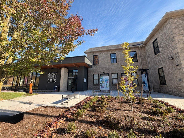
My first students arrived in 1856. The oldest part of me began as Elora's girls' school. Ten years later, a boys' school was built alongside it. Then, in 1871, something happened here that was controversial enough to become part of my story: boys and girls began attending school together.

Another major addition arrived in 1874. Electric lights and washrooms were added in 1927. In 1939, a three storey wing was built to accommodate a growing high school population; a stone addition believed to be the last of its kind constructed in Elora. Generations of students passed through my doors.

By the time I finally stopped operating as a school in the 1990s, parts of me had been serving that purpose for roughly 140 years. Then the classrooms found a new use. The Elora Centre for the Arts opened here in 2003. Former classrooms became studios, galleries, teaching spaces, and places for community organizations.

And in 2024, construction began on another chapter. A new 3,500 square foot addition created more room for gatherings, exhibitions, and performances. It also addressed something the old schoolhouse struggled to provide; full accessibility. The project added accessible spaces, universal washrooms, and clearer ways to move through the building. That matters when we talk about planning and the built environment. Buildings can last for centuries, while expectations about who should be able to use them, and how, continue to evolve.

Heritage conservation involves choices about how older places can continue serving a community. Sometimes that means repairing original materials, sometimes it means finding an entirely new use, and sometimes it means adding something new so that more people can participate in the life happening inside. In 2026, the Township recognized this project with its Making Heritage Accessible Award.

This protected heritage building has been altered many times since 1856. Each generation has left something behind to help it meet the needs of the next one. Just across the way, we'll find a place where the transformation was even more dramatic. Instead of adapting an old building, the community eventually gave an old industrial site an entirely different role. Our next stop is Bissell Park.

1 sound

Bissell Park

It's probably difficult to picture now, but for much of the last century, you wouldn't have come here for a picnic, you would have come to work. Before I became Bissell Park, this stretch of the Grand River was occupied by a large industrial complex. A carpet factory had been built here in the 1870s, taking advantage of Elora's growing industrial economy and its relationship with the river.

By the end of the century, those factory buildings were sitting vacant. Then, in 1901, the Village of Elora made a deliberate investment in bringing industry back to the site. The municipality offered businessman T.E. Bissell a $5,000 interest free loan and transferred the former factory property to his company. Within months, machinery was running again.

The T.E. Bissell Company manufactured agricultural equipment here, beginning with horse-drawn disk harrows. Its products eventually reached customers across Canada, the United States, and overseas. At its peak under later ownership, the factory employed roughly 200 people.

Imagine the landscape around you then: large industrial buildings, machinery, workers arriving for their shifts, the sound of manufacturing, and the Grand River serving an economic purpose as well as a scenic one. Bissell even constructed a new dam and power plant here in 1909. The dam remains part of the river landscape today.

The factory's fortunes declined after the Second World War, and production ended in the 1950s. The empty industrial buildings survived for several more years before they were eventually demolished.

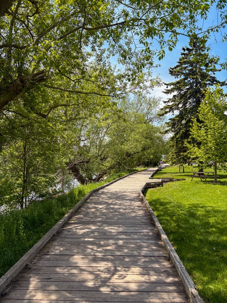
The land remained. And over time, its purpose changed completely. Today, this is municipal parkland; a place for walking, recreation, community events, gathering and access to the river. The park includes a multi-use recreation area and community facilities, and it continues to receive public investment as its use evolves.

That transformation is part of planning too. Land can carry the imprint of several very different eras. A site that once supported manufacturing and employment can later become part of a community's network of parks and public spaces, while remnants of its industrial past remain visible in the landscape.

Before you leave, take another look toward the river. More than a century ago, the water beside you helped power industry. Today, it forms part of the experience of being in a public park. When you're ready, begin walking west along Mill Street East toward downtown. For the next part of the tour, you don't need to stop immediately. Just pay attention to the street.

1 sound

Mill Street East

Walk with me for a minute. You already know that planning leaves traces in individual buildings. Now look at what happens when those buildings begin working together as a street.

Near Bissell Park, Mill Street East has a distinctly residential character. Homes sit back from the road behind lawns, gardens, and mature trees. Buildings have space around them, driveways lead into individual properties, and the street feels quieter and more open than the commercial blocks nearby.

One of the most recognizable examples of the residential character is 23 Mill Street East, the white home located on your left along this stretch. The 1.5 storey dwelling forms part of the older residential streetscape along Mill Street East, leading into the downtown area. Its modest scale, front setback, and residential character are quite different from the distinctive commercial area and mixed-use buildings located only a short distance ahead.

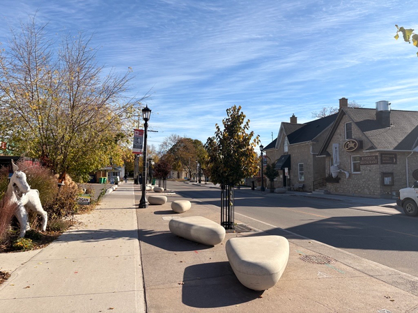
Keep walking west. Watch what happens as you approach the centre of the old village. Front yards begin to get smaller, buildings move closer to the sidewalk, detached houses start sharing the street with commercial buildings and other uses, entrances turn toward passing pedestrians, windows become part of storefronts, and buildings gradually sit closer together. The change happens gradually, which is exactly why this stretch of Mill Street East is interesting.

This brings us to an important idea in planning, called complete communities. A complete community is one where people can access many of the things they need in their daily lives, such as housing, jobs, shops, services, parks, and places to gather, without having to travel far. It doesn’t mean that every street needs to have everything. Instead, it’s about creating neighbourhoods where different uses and activities complement one another, and where people have choices in how they get around.

Think about the places you’ve passed on this walk so far. From Bissell Park, through this residential neighbourhood, and now toward the shops and services of downtown, many different parts of community everyday life are connected within a relatively short distance. That’s part of what makes complete communities so valuable. When homes, services, and public spaces are well connected, people have more opportunities to walk, cycle, and participate in community life.

Urban design guidelines play an important role in bringing these connections together. Things like sidewalks, building setbacks, landscaping, street trees, and the relationship between buildings and the street all influence how comfortable and inviting a place feels. As you continue toward downtown, notice how those details change around you. There isn't a gate marking the point where one neighbourhood ends and the downtown begins. Instead, you can see the transition taking place along the street itself. Keep following Mill Street East toward Geddes Street.

1 sound

Elora Greenspace

For roughly 80 years, this corner had a very different purpose. Beginning in the 1930s, it was home to a gas station. Cars came and went, fuel was sold here, and the corner served movement.

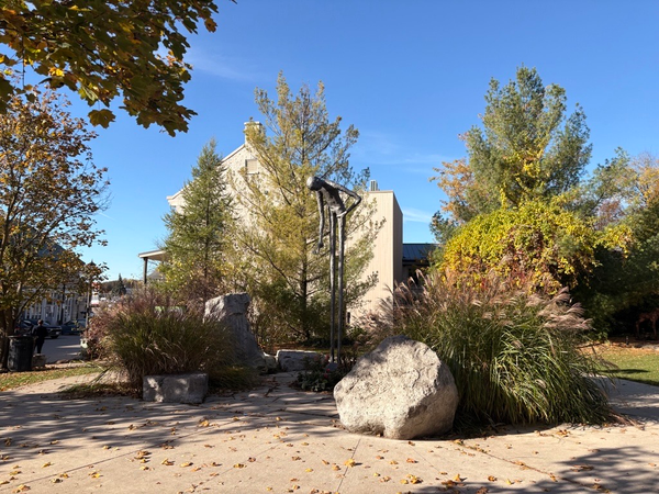
Then, in 2012, the Elora Business Improvement Area, the Township, and members of the community worked together to transform the site. I became the Elora Greenspace. Look around. There isn't much building here, and that's precisely what makes me interesting.

In a downtown where land has considerable value and buildings sit close together, this corner was deliberately made into a place where people could stop and gather. There are places to sit, gardens and landscaping that soften the intersection, and public art that appears throughout the space, such as the iconic “Tall Man” and works associated with the Elora Sculpture Project. Festivals and community activities spill into this area. And perhaps most importantly, people can simply be here without needing to buy anything. Places like this are sometimes described as third places. A third place is a space outside of home and work where people can meet, spend time, and feel connected to their community. A place like me can be especially valuable because I create low-barrier opportunities for casual interaction, social connection, and belonging.

Planners often use the term “public realm” to describe the spaces we experience collectively: sidewalks, streets, parks, plazas, trails, and other places between buildings. Those spaces influence how a downtown feels just as much as the buildings themselves. Think about what happens when somewhere to pass through becomes somewhere to pause. You notice the storefronts, run into someone you know, sit down, and stay a little longer.

Small public spaces can have an influence far beyond the size of the property they occupy. My own story is written directly into the change from gas station to gathering place; from a corner organized around serving a vehicle to one organized around serving a person.

Before you continue, look west along Mill Street West. This is the intersection where Mill Street East turns into Mill Street West. The buildings ahead sit tightly against the sidewalk, creating the enclosed Main Street character that has come to define this part of Elora. Walk a short distance west toward 43 Mill Street West.

1 sound

43 Mill Street West

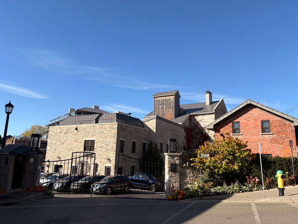
I've been part of Mill Street West since its earliest days. The oldest portions of this property date to the mid-nineteenth century, when I was known as the Commercial Hotel. I was the first hotel in Elora modeled on the size and style of big city hostelries and the first building on this street.

For a growing nineteenth century village, a hotel was far more than somewhere to sleep. Places like me were woven into commercial, political, and social life. Travellers arrived, business was conducted, and people gathered, ate, exchanged news, and made connections.

As the street developed around me, I became part of the street wall you see today. Nearly two centuries leave their mark on a building. Over time though, pieces change, materials weather, original features disappear, and new uses arrive.

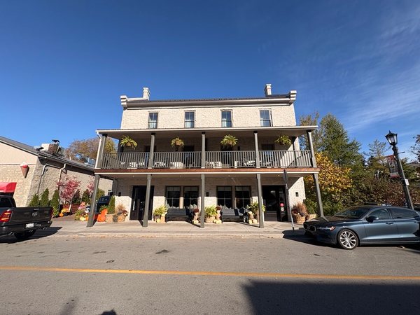
A major restoration of this property recently turned back to the historical record to recover some of those lost details. The work included restoring the original exterior stone, reconstructing the historic roofline and front façade, carrying out extensive interior renovations, and bringing back a second storey balcony that had once overlooked Mill Street West.

In 2025, the Township recognized the restoration of 43 Mill Street West with a Heritage Property Restoration Award, along with a separate award for the professional team behind the work.

Another part of this property has its own long-running community story. The Gorge Cinema has operated here since 1974. In 2024, it marked fifty years of showing films in downtown Elora and received the Township's Heritage Stewardship Award the following year. That adds another layer to what you're looking at.

Heritage buildings survive through materials like stone and timber, but their continued use matters too. Restaurants, shops, workplaces, accommodation, entertainment, and homes all give older buildings like me reasons to remain part of everyday life.

Look along Mill Street West from here. The restored stone façade, the balcony above the sidewalk, neighbouring storefronts, and the narrow street all contribute to an experience that has been built up piece by piece over generations.

Our next stop takes that story toward the river. Continue west along Mill Street West toward the Jack R. MacDonald pedestrian bridge to the left.

1 sound

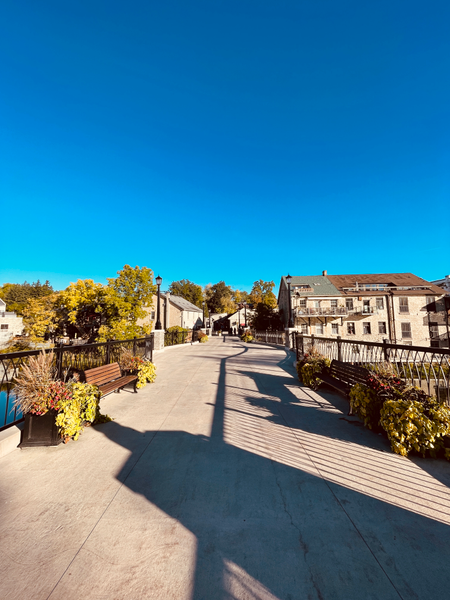
Jack R. MacDonald Pedestrian Bridge

I've carried wagons, cars, movie crews, and generations of people across the Grand River. And I haven't always looked like this. A bridge has crossed the river at this location since the 1840s. For more than a century, this was an important route into Elora's commercial centre.

The crossing was rebuilt several times as transportation changed and older structures wore out. Stone piers were constructed in the nineteenth century, and in 1899, they supported a new steel truss bridge. For decades, people drove across me. Then, another crossing changed my role.

After the Metcalfe Street bridge opened in the 1950s, vehicle traffic gradually shifted away. By 1969, the Victoria Street Bridge, as I was then known, had closed to vehicles and I became a walking bridge. That transition says something interesting about infrastructure.

A route built for one purpose can continue to be valuable long after that original purpose changes. Once cars stopped using my crossing, I still offered something important: a direct connection between the south side of the river and the shops, businesses, and public spaces of downtown Elora on the north side.

My next chapter came from an unexpected source. In 1984, Metro-Goldwyn-Mayer came to Elora to film the movie Mrs. Soffel. The production contributed $35,000 toward restoring the bridge so it could once again be used by pedestrians. For a time, wooden decking carried people across the old steel structure. But eventually, age caught up with me again. The bridge closed, and most of the old structure was removed in the mid-2000s. The stone piers remained standing in the river. For more than a decade, there was no crossing here.

Then, in 2016, a major gift from Jack R. MacDonald created an opportunity to reconnect the two sides. The Township received nearly $3.5 million from MacDonald for projects intended to have a lasting positive impact in the former Village of Elora. Council directed $1.8 million of that gift directly toward rebuilding my pedestrian bridge and improving the public realm along Mill Street West. The new bridge opened in 2019. And those old stone piers? They're still here. The bridge you're standing on today is a new piece of infrastructure supported by parts of crossings that came before it.

Take a moment to look in both directions. Behind you to the north is Mill Street West, with its shops, restaurants, historic buildings, and public spaces. Across the bridge to the south are neighbourhoods, parking areas, and other parts of the community. You’ll see a large new redevelopment in progress on the south side of the river associated with the mill redevelopment to the north. It will include a residential condominium building, hotel and conference centre, restaurants, spa, parking structure, and retail uses, all connected by pedestrian walkways within the development and alongside the river.

A short pedestrian connection changes how all of those places relate to one another. It can shorten a trip, create another way into downtown, make it easier to leave the car behind, bring people close to the river, and turn the crossing itself into a place where people stop, look around, and spend time. A bridge can do more than get you from one side to the other. Here, the journey across has become part of the experience of downtown Elora.

The river beneath us has shaped this community for far longer than any bridge has stood here. It influenced where people settled, where industries developed, and how Elora became connected to the wider region.

At our next stop, we'll look more closely at one of the buildings that depended on that relationship with the river, and at how the public spaces around Mill Street West have changed with it. When you're ready, make your way back toward Mill Street West and walk to the west towards the historic mill.

1 sound

The Elora Mill & Mill Street West

If you've wondered why the village of Elora grew here during European settlement, the river beside me is a good place to start. Long before Elora developed as a European settlement, Indigenous Peoples, including the Anishinaabe and Haudenosaunee, had longstanding relationships with the Grand River and the lands around it. As European settlement expanded during the nineteenth century, the river began to play a new role in the development of the village, particularly as a source of power for industry.

Elora's first sawmill was built here beside the Grand River in 1833. Water was a major economic resource at the time. The river could turn machinery, support manufacturing, and give early businesses access to the power they needed to operate. In the 1840s, a larger mill complex began developing here, and industry expanded along both sides of the river.

By the 1860s, shops were filling in along East and Mill Street West and Elora's business district was extending uphill along Metcalfe Street. The shape of downtown was taking form around industry. I've changed considerably since then. Major fires damaged and destroyed parts of the mill complex during the nineteenth century, including serious fires in 1859 and 1870. Each time, the site was rebuilt, enlarged, and adapted. Grain moved through here, machinery ran here, people worked here, and businesses grew around me because of it.

The river also supported an entire industrial landscape nearby, including woolen mills, foundries, furniture manufacturing, and other enterprises that once filled this part of Elora with workers, materials, and machinery. Much of that industry eventually disappeared, but the buildings and streets it helped create did not.

Look eastwards back along Mill Street West. The narrow roadway, limestone buildings, storefronts close to the sidewalk, and the mill at the end of the street create one of Elora's most recognizable view corridors. That relationship between buildings and street has been reinforced through more recent public investment.

When the Jack R. MacDonald pedestrian bridge was rebuilt, Mill Street West was improved alongside it. This extensive project included new paving and sidewalks, as well as pedestrian amenity areas with features such as landscaping, trees, and benches. Those details influence how a street works. A bench gives someone a reason to pause, wider or more comfortable sidewalk makes walking easier, trees and landscaping create shade, enclosure, and separation from traffic. Storefronts close to the sidewalk give people something to look at as they move through the street. Together, those individual elements shape the experience of a downtown.

This street has been adjusting to new uses for almost two centuries. Factories became shops, industrial buildings found new uses, and that vehicle bridge became a pedestrian connection. Spaces once organized around moving goods and machinery increasingly became places for people to experience; walking, shopping, gathering, and spending time beside the river.

The Grand River is still shaping Elora. Its role has changed, but the relationship between the river, the buildings around it, and the people who use this place remains one of the defining features of the community.

For our last few steps, head back along Mill Street West toward the Elora Mews on the north side. There's one final piece of Elora's commercial history waiting there.

1 sound

Elora Mews

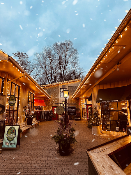
Before we finish this walking tour, take a look around the Mews courtyard. This small corner of Mill Street West has its own connection to Elora's industrial past. By the late nineteenth century, the Mundell Furniture Company had become one of Elora's important manufacturers. Furniture was produced and finished at several properties around the village, including buildings along Mill Street West and on the south side of the river.

In 1898, the company opened a retail store in the buildings now known as the Elora Mews. More than a century later, people are still coming through this space to browse, meet, shop, and spend time downtown. That feels like an appropriate place to end.

Over the course of this walking tour, we've moved through nearly two hundred years of decisions about land, buildings, and public space, and seen how these choices continue to shape community life today.

We've seen a new mixed-use building add rental homes to an established downtown, followed older buildings through new uses, visited a school that became an arts centre, a factory site that became a park, and a gas station that became a public gathering space. We've watched a residential street gradually become a commercial one, and seen heritage buildings restored, a bridge returned to the river, and public spaces redesigned around the way people experience downtown on foot.

Each place carries more than one story, and each generation adds another layer. That ongoing process is part of planning. While the changes to the properties and streetscapes we’ve visited were often not historically a direct result of decisions made by land use planners, today’s decisions are guided and influenced by them. The streets and buildings around you reflect choices made decades ago alongside decisions being made today. Together, they influence where people live, how they move, where they gather, what gets preserved, and how familiar places continue to adapt.

There are shops, cafés, places for a treat, and spaces to sit throughout the streets around you. Take some time to explore, and as you do, see how many of the planning details you've noticed along the way begin to appear in the rest of downtown Elora.

Thank you for joining us in Elora for World Town Planning Day.

Our walk ends here, but you're in a good place to stay a while.

1 sound

DOWNLOAD OUR APP TO DISCOVER THIS TOUR AND MANY OTHERS.

play-storeapp-store

Or start creating tours, treasure hunts, POI maps... Just let your imagination guide you.


Other walks nearby

CAFKA 23: One thousand, one hundred - Kandis Friesen | June 3 - July 22, 2023

CAFKA 23: One thousand, one hundred - Kandis Friesen | June 3 - July 22, 2023

Waterloo
ONE THOUSAND, ONE HUNDRED | KANDIS FRIESEN 2023, site-specific installation with sound, sculpture, and artist text ARTIST TEXT — The artist has written an essay about the trees and their monumentality. You can pick up a print version at the two tree locations (Conrad Grebel College & MCC Ontario) during office hours, or download the text here: https://files.cargocollective.com/537319/KFriesen\_CAFKA\_Essay.pdf INSTRUCTIONS — The three sites on the map are all part of the installation. The two tree sites hold a sound installation: a 45’00 field recording of sunrise at the ancient Khortitsa oak tree in Zaporizhzhia, Ukraine this spring. The audio will play automatically when you enter the circle on the map. Use headphones for a more immersive auditory experience. The third site is a billboard installation, which holds no sound installation; here, you can listen to the sounds surrounding the billboard sculpture. You can visit one or all of the locations, in any order. LOCATIONS — The installation is comprised of a sculptural billboard in Waterloo Park, and two virtual sound installations at Khortitsa oak trees growing in the Waterloo region: SITE 1 (TREE with SOUND) - CONRAD GREBEL COLLEGE (140 Westmount Rd N, Waterloo, ON) SITE 2 (BILLBOARD with no SOUND) - WATERLOO PARK (near Westmount Rd entrance, west of the Bandshell) SITE 3 (TREE WITH SOUND) - MCC ONTARIO (50 Kent Ave Unit 203, Kitchener, ON) ACCESSIBILITY — Information for each site is listed at the end of this page, and in the description of each site. PROJECT DESCRIPTION — One thousand, one hundred is an installation in sculpture and sound, triangulating a series of trees and their monumental forms. The work is grafted onto the Ukrainian / Russian Empire Mennonite practice of visiting the ancient Khortitsa oak tree in Zaporizhzhia, Ukraine, and planting its acorns in the diaspora: a slowly growing and dispersed installation of oaks around the world. Like many immigrant-settler communities, Ukrainian Mennonites often emphasize historic hardship as a way of obfuscating colonial alliances, and Mennonite narratives hold both a beautiful relationship to diaspora and a deep denial of collusion with empire, whether Russian or British/Canadian. The planting of these acorns is a poetic and material gesture that holds these things close together. This installation triangulates these trees-as-monuments in southern Ontario and southern Ukraine, marking the diasporic oaks through disrupting the narratives that accompany them. The acts of visiting and listening are central to the work. OAK TREE SOUND INSTALLATIONS — The sound installation is virtually installed at two local Khortitsa oak trees, with a suggested listening time at sunrise, though you can visit at any time of day. Unfolding over 45’00, the ambient recording is an invitation to visit the trees as a listening session, listening to the recording and to the site around the tree. Both trees feature the same stereo field recording of an April morning sunrise at the ancient oak tree in the Khortitsa suburb of Zaporizhzhia, a time that is usually quiet except for blastingly bright birdsong. This recording begins at 5:30 am, with dozens of birds and their songs and signals sounding alongside the active hum of traffic, with trucks already on the road after the nightly 5am curfew, the war conditioning daily rhythms in subtle and constant ways. BILLBOARD SCULPTURE — Located in Waterloo Park just west of the Bandshell, the sculptural billboard holds a close-up image of the the nine-hundred-year-old oak, which is slowly drowning due to the water table rise from a nearby hydroelectric dam, built during the first Stalinist five year plan in 1932. In an effort to save the tree in the 1990s, the city of Zaporizhzhia erected metal poles, flags, and ropes, evoking a ships masts, creating the strange image of an ancient tree dressed up as a ship, slowly drowning on dry land. The billboard’s photograph crops out this monumental scaffolding, and focuses instead on the wire wrapped around its branches, and the concrete pushed into its broken limbs — attempts at holding its disintegrating body together, into some kind of maintained whole. The billboard faces Laurel Creek, part of the watershed of the Grand River, echoing the ancient tree’s location next to Upper Khortitsa Creek, that flows into the Dnipro just before the dam. The billboard’s sculptural form draws from the dam itself, designed by constructivist architects Kolli and Vesnin, and built with expertise from Canada and US engineers, who had just built massive colonial dam projects in Turtle Island before traveling to southern Ukraine. — CREDITS Sound & Sculptural Installation, Text, and Design: Kandis Friesen Audio Recording: Maryna Svyrydova Production & Support: Caitlin Sutherland, Marilyn Adlington, Rex Lingwood, Michael Jacob Ambedian, Eric Almberg, Graham Whiting — This work was produced as part of CAFKA 23: Stay with me, June 3 - July 22, 2023 Kandis Friesen | https://kandisfriesen.com/ CAFKA | https://www.cafka.org/cafka23/stay-me — ACCESSIBILITY CONRAD GREBEL COLLEGE (140 Westmount Rd N, Waterloo, ON, N2L 3G6) The garden area where the oak tree is located is accessible by a hard gravel path, that leads from the parking lot down to the tree with no curb. There is a bench right next to the tree.  There is an accessible washroom just inside the main entrance (open 8am-5pm weekdays) MCC ONTARIO (50 Kent Ave Unit 203, Kitchener, ON, N2G 3R1) There is a short stone wall right beside the tree for sitting. The tree is in a small garden area along the parking lot road: one can access the road with a wheelchair, but it’s a throughway. You can position yourself anywhere within the circle on the map to hear the recording, including inside the foyer of the MCC building and the green path behind the parking lot. There is an accessible washroom, accessed via the Thrift Store (open 10am-5pm weekdays and Saturday) BILLBOARD at WATERLOO PARK (Westmount Road Entrance / 100 Father David Bauer Dr, Waterloo, ON N2L 2Y4) The billboard is just west of the Bandshell, facing Laurel Creek. Most walkways in the park are packed dirt, and the way from the Bandshell to the billboard is on hard ground / grass. There are accessible washrooms on the east and west sides of the park.
free

Are you a creator?

START HERE

Privacy & cookie policy / Terms and conditions

© ECHOES. All rights reserved / ECHOES.XYZ Limited is a company registered in England and Wales, Registered office at Merston Common Cottage, Merston, Chichester, West Sussex, PO20 1BE

v2.5.19 © ECHOES. All rights reserved.